Is Oslo Walkable? A Self-Guided Walking Route Through the City
Oslo is one of Europe's most walkable capitals: the whole sightseeing core sits inside a 3 km stretch of waterfront and street grid, and this route strings it together stop by stop.
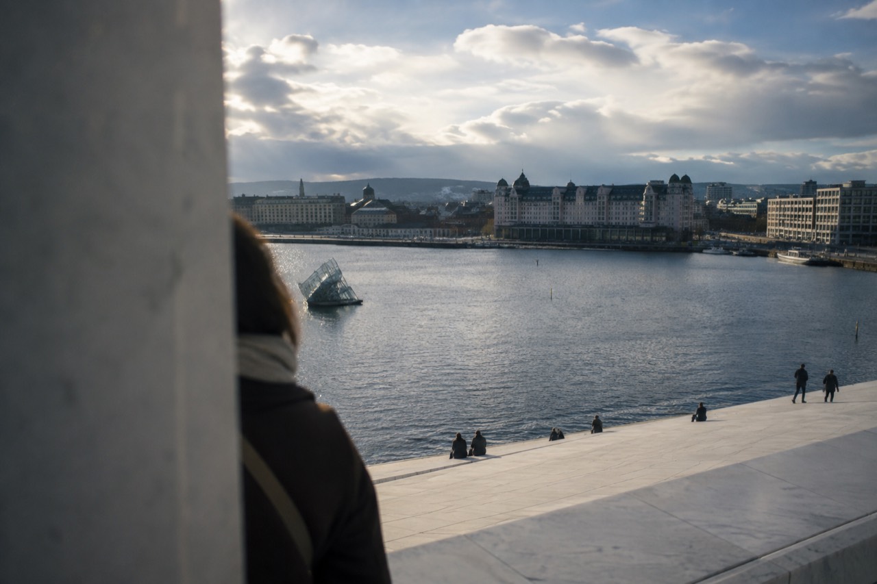
Short answer
Yes, Oslo is highly walkable. The center is compact and flat, with the Opera House, Karl Johans gate, City Hall, Aker Brygge and Akershus Fortress all within a 20 minute walk of each other. Expect 3 to 5 km of easy walking for a full sightseeing day, with the Oslofjord never more than a few blocks away.
Is Oslo Walkable?
Yes, Oslo is genuinely walkable, and unusually so for a capital. The sightseeing core fits inside a rectangle roughly 3 km long, bounded by the Oslofjord on the south and the Grünerløkka district on the north. The Opera House, Karl Johans gate, City Hall, Aker Brygge and Akershus Fortress are all within a 20 minute walk of one another, on flat, well-marked ground.
That compactness is the short answer, but the longer answer is what makes Oslo worth walking rather than just possible to walk. The city rebuilt its entire waterfront over the past two decades, so the stretch from the Central Station to Tjuvholmen is now a continuous promenade of piers, bridges and public art rather than the industrial dockland it used to be. The street grid in the center dates to the 17th century and has barely moved, which means short blocks, frequent intersections and a layout that rewards wandering.
The terrain cooperates too. The center is flat; the hills, at Holmenkollen and in Nordmarka, sit at the end of metro lines you only ride if you choose to. Pedestrian zones cover much of Karl Johans gate and the streets feeding it, and the Oslofjord acts as a compass: if you can see water, you are facing south. Norwegians walk as a default, so crossings, curb cuts and winter clearing are all designed around people on foot rather than as an afterthought.

For anything you want to read in depth rather than walk past, the things to do in Oslo overview sorts the whole city by interest, and our Oslo map and orientation guide explains the grid in more detail.
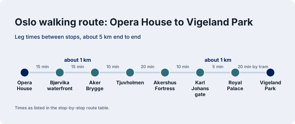
The Full Walking Route, Stop by Stop
This route runs about 5 km end to end and takes a full day at museum pace, or about three hours if you only pause for photos. It starts at the Opera House, runs west along the waterfront through Bjørvika, Aker Brygge and Tjuvholmen, loops back through Akershus Fortress and up Karl Johans gate to the Royal Palace, and ends at Vigeland Park if your legs are still willing.
The route works in either direction, but starting at the Opera House has one advantage: it is on top of Oslo Central Station, so you begin the walk the moment you step off the train. Starting east also puts the sun behind you for the morning stretch along the water, which matters more than you would think for photographs.
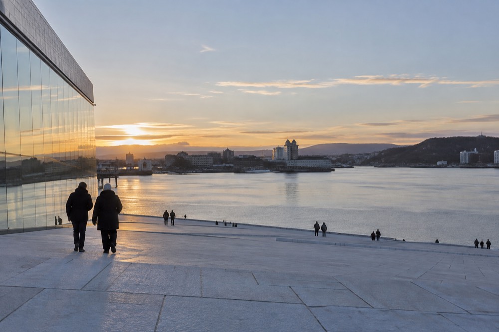
Stop 1: the Opera House. The sloping marble roof is free to walk on, no ticket, and it is the single best orientation point in the city: from the top you can see the whole route ahead of you, from the Barcode towers to the ferries at Aker Brygge. Give it 20 minutes. The Opera House guide covers what is inside if you want a performance or a tour.
Stop 2: the Barcode and Bjørvika waterfront. Head west from the Opera House along the promenade, past the MUNCH museum. The walk is about 1 km to Aker Brygge and it is the newest ground in the city, a district that did not exist in this form a generation ago. If you want to break the day with art, adult admission at MUNCH is 280 NOK, and under-25s pay 100 NOK. The building itself, with its distinctive kinked tower, is worth the detour even if you do not go inside.
Stop 3: Aker Brygge and Tjuvholmen. The old shipyard is now Oslo's restaurant strip, and the Aker Brygge area guide has the eating options. This is also where the island ferries leave, from the Aker brygge pier, on ordinary Ruter tickets. Continue past the restaurants onto Tjuvholmen's narrow quays and you reach the beach and the Astrup Fearnley museum, where adult admission is 180 NOK and under-20s enter free.
Stop 4: Akershus Fortress. Cross back east along the water and the medieval fortress grounds are free to wander, with views back over the fjord you have just walked. The Akershus Fortress guide explains what is open and what the small museums inside cost.
Stop 5: Karl Johans gate to the Royal Palace. The city's main street runs about 1 km from the Central Station end up to the Royal Palace, and the whole length is a walk of 15 minutes without stops, considerably longer with them, because the street collects the Cathedral, the Parliament, the National Theatre and the university along the way. Our Karl Johans gate guide walks it building by building.
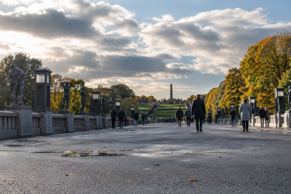
Stop 6: Vigeland Park. Take tram or metro west to Frogner. The sculpture park is free, open 24 hours a day, all year, with over 200 sculptures. Our Vigeland Park guide covers what you will be looking at, and why the monolith took a single sculptor decades to assemble.
The table below is the route in one view, with honest walking times between stops.
| Stop | What it is | Time on site | Walking time from previous stop |
|---|---|---|---|
| Opera House | Free marble roof, fjord views | 20-30 min | Start |
| Bjørvika waterfront | Promenade past MUNCH | 20-30 min | 15 min |
| Aker Brygge | Piers, restaurants, ferries | 30-60 min | 15 min |
| Tjuvholmen | Beach, Astrup Fearnley museum | 30 min | 10 min |
| Akershus Fortress | Medieval grounds, free entry | 45-60 min | 20 min |
| Karl Johans gate | Main street to the palace | 30-45 min | 10 min |
| Royal Palace | Grounds and facade | 20 min | 5 min |
| Vigeland Park | Free sculpture park | 60-90 min | 20 min by tram |
How Long the Route Takes, and When to Walk It
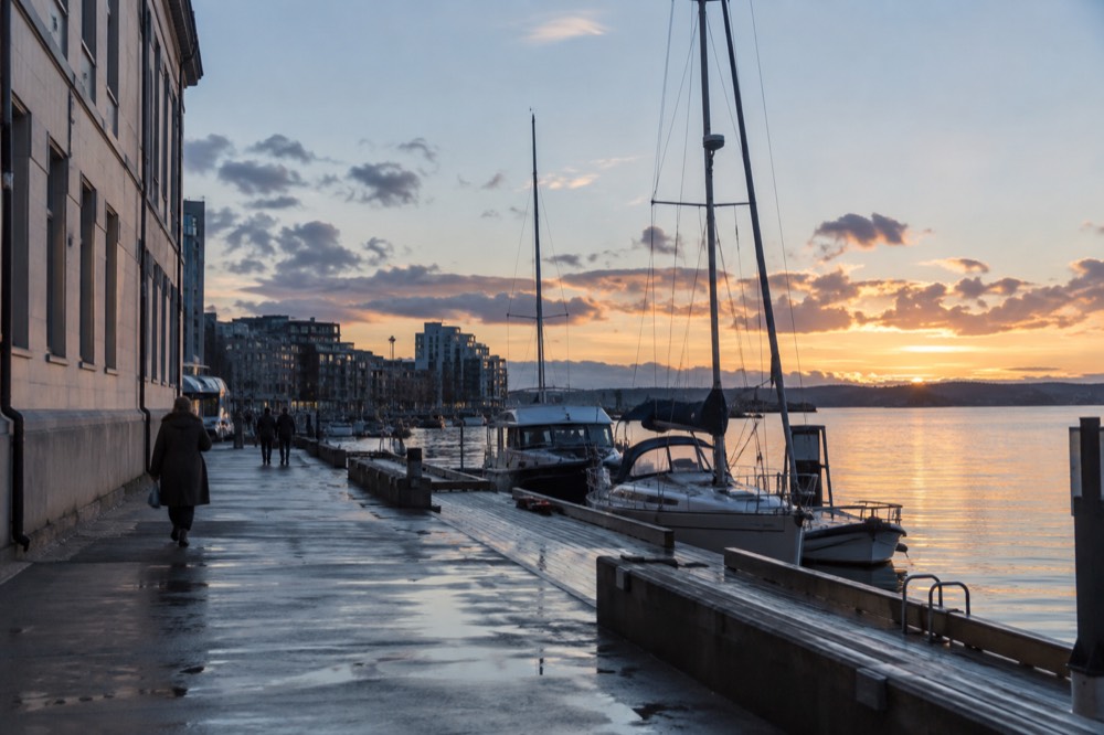
Count on six to eight hours for the full route with museum stops, or three hours at photo pace. The best walking months are May through September, when the waterfront stays light past 21:00; in December the sun sets at 15:11 and you will want to start at 09:00 to finish in daylight. Daylight in Oslo swings from 5 h 53 m in late December to 18 h 50 m in late June, so the season changes the route more than the weather does.
The daylight point deserves its own sentence because it is the planning fact visitors most often get wrong. On 21 June the sun rises at 03:53 and sets at 22:43, and the gap between is twilight rather than true darkness, so an evening walk along the fjord is genuinely pleasant. On 21 December the sun rises at 09:18 and sets at 15:11, so the same walk happens in the dark or not at all. Our Oslo daylight hours guide has the full month-by-month table.
Season by season, this is how the route behaves:
| Season | Daylight feel | Route notes |
|---|---|---|
| December-February | 6-9 h, dark by 16:00 | Compact version: Opera House to City Hall, museums as warm-up stops |
| March-April | 12-15 h | Full route works, waterfront is quiet |
| May-June | 17-18.5 h | Best walking conditions, longest days |
| July-August | 15-18 h | Warmest, but August averages 103 mm of rain, the wettest month |
| September-October | 11-13 h | Full route still works, pack a layer |
One weather fact that surprises people: August, not November, is Oslo's wettest month on the 1991 to 2020 normals, at 103 mm. July's normal mean temperature is a mild 17.7 °C, so summer walking is comfortable rather than hot, and you will rarely need more than a light jacket for an evening on the waterfront. More of these guides are collected on Oslo Travel Guide. More of these guides are collected on Oslo Travel Guide.
If you would rather have the route's central stretch explained than read it off a phone, the Budget Central Walking Tour covers exactly this ground with a local guide.
What the Route Costs on Foot
The route itself costs nothing: every outdoor stop on it, the Opera House roof, the fortress grounds, Karl Johans gate, the waterfront promenade and Vigeland Park, is free. What you pay for is what you go inside. A day of walking with two museum entries runs roughly 360 to 560 NOK per person; a 24-hour Oslo Pass at 580 NOK covers over 30 museums plus the transport between them.
The free list is longer than most capitals can offer. Vigeland Park is free, open 24 hours a day, all year. The Opera House roof is free. The fortress grounds are free. The whole waterfront promenade is public. If you want a genuinely zero-cost day in this city, this route delivers it, and our free things to do in Oslo guide extends the list.
The paid entries you are most likely to add:
| Attraction | Adult price | Notes |
|---|---|---|
| MUNCH | 280 NOK | 200 NOK after 18:00, under-25s 100 NOK |
| Kon-Tiki Museum | 180 NOK | Requires the Bygdøy ferry or bus 30, a detour off this route |
| Fram Museum | 180 NOK | Next door to Kon-Tiki |
| Kon-Tiki + Fram combo | 325 NOK | Saves 35 NOK over two singles |
| Norsk Folkemuseum | 200 NOK | Children 0-17 free |
| Vigeland Museum | 120 NOK | The museum, not the free park |
| Oslo Pass, 24h | 580 NOK | Over 30 museums plus zones 1-4N transport |
Food is where a walking day gets expensive in Oslo, not the sights. Statistics Norway's 2025 price comparison puts food and non-alcoholic drink 33% above the European average, and alcohol more than double. A supermarket picnic eaten on the fortress ramparts is the budget answer; a sit-down lunch on Aker Brygge is not. The Oslo on a budget guide has the fuller breakdown, and the Oslo trip cost guide adds the per-day math.
Detours Off the Route
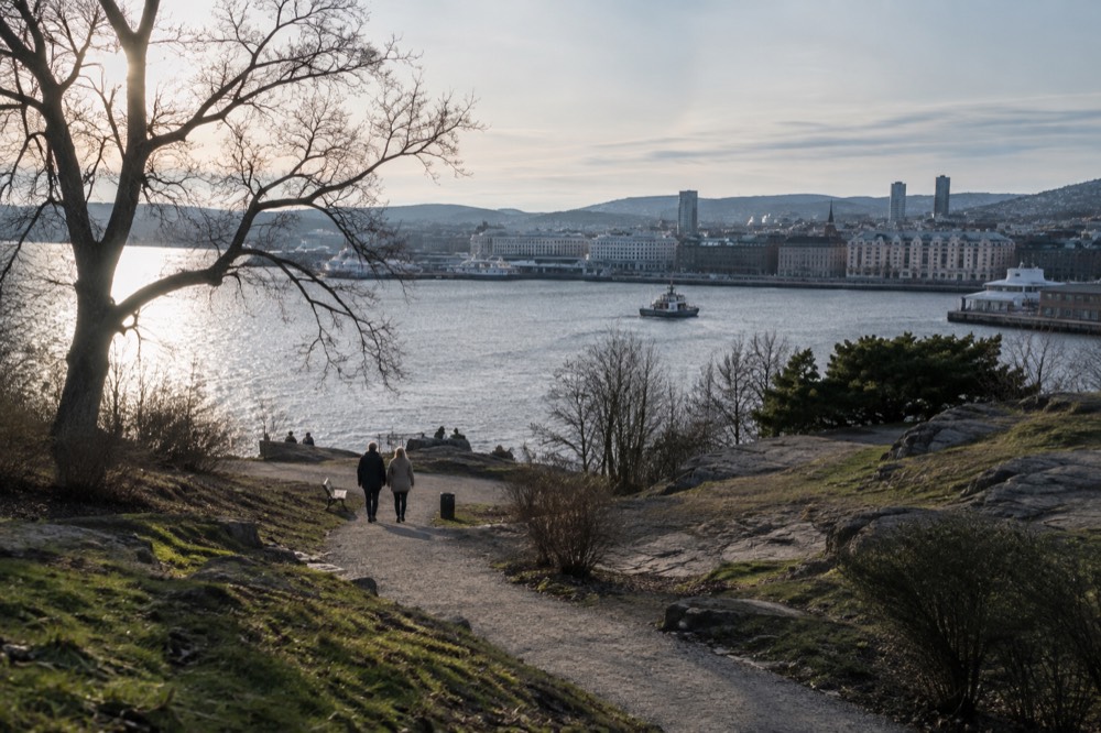
Three detours earn their walking time: Grünerløkka across the river for cafés and street art, the Oslofjord islands by ferry from Aker brygge, and the Ekebergparken sculpture park on the east side of the fjord. Each adds two to three hours and none needs a car.
Grünerløkka is a 15 minute walk north of Karl Johans gate across the Akerselva river, and the Grünerløkka guide covers it. The river path itself is one of the nicest walks in the city, running from the Grünerløkka waterfalls down to the MUNCH area through old industrial yards now turned into housing, studios and cafés. Ekebergparken sits on the hill directly opposite the Opera House and combines forest paths with an outdoor sculpture collection; it is the east-side answer to Vigeland, and the Ekebergparken guide covers the collection.
The island detour is the most Oslo-specific one. The B1 ferry from Aker brygge runs to Hovedøya, with its ruined Cistercian abbey, on an ordinary Ruter ticket, and the crossing takes about 10 minutes. Our Hovedøya guide covers what is on the island, and the Oslo islands overview covers the rest of the archipelago. Note the pier rule, because it is the most confused fact in Oslo guidebooks: the island ferries leave from Aker brygge on Ruter tickets, while the Bygdøy museum ferry leaves from Rådhusbrygge 3, runs only from 14 March to 4 October, and does not accept Ruter tickets, though the Oslo Pass covers it.
If a detour sounds better with someone who knows the ground, the locals-led free walk is a tip-based alternative that covers central Oslo in about two hours.
Walking Oslo in Winter
Yes, the route works in winter, in a shortened form. Oslo clears its main pedestrian streets and the waterfront promenade reliably, and the winter version of this route, Opera House to City Hall to Karl Johans gate, is about 2 km of walkable ground with indoor museums as warm-up stops. Expect ice underfoot on side streets and about six hours of daylight in December.
The winter route inverts the summer logic. Instead of long outdoor stretches, you walk short hops between warm interiors: the National Museum, MUNCH, the City Hall, all within a few blocks of one another. The waterfront in winter is at its best around 15:00, when the low sun puts long light on the fjord for the last hour before sunset. The trade is honest: you lose the long golden evenings and you gain the city at its most Norwegian, with the fjord grey and the cafés full.

Two practical winter notes. First, the Bygdøy ferry stops running from early October, so a winter Bygdøy detour means bus 30, which is a year-round Ruter service. Second, the dark season is exactly when Oslo's evening walks earn their keep, and the myths-and-legends format exists for these months, a two-hour themed walk through the city's darker history that only really makes sense after the sun has gone down at four in the afternoon.
| Winter walking factor | What to expect |
|---|---|
| Daylight, late December | Sun up 09:18 to 15:11, 5 h 53 m total |
| Pavement conditions | Main streets cleared, side streets can be icy |
| Waterfront | Open, exposed to wind off the fjord |
| Bygdøy ferry | Not running, use bus 30 |
| Island ferries | B1 runs year-round at reduced frequency |
Our Oslo in winter guide extends all of this, and the Oslo in December guide covers the market season, which is the one stretch of the winter calendar when the walking route is genuinely crowded.
When Your Feet Give Out: Transport That Rescues the Route
Every point on this route sits within a few minutes of a tram, metro or ferry stop, so you can abandon the walking at any stop without planning ahead. The T-bane reaches Frogner and Majorstuen for the Vigeland leg, trams 12 and 13 shadow the waterfront, and the whole metro network is inside Ruter zone 1, so a single zone ticket moves you between any two points on the route.
That rescue network is the reason Oslo's walkability does not trap you. You never have to commit to the full 5 km. The classic bailout is the Vigeland leg: walk Karl Johans gate west, then ride the tram to Frogner and walk only the park itself. The reverse works too, riding out to Vigeland first and walking home downhill all the way to the water. The getting around Oslo guide covers the ticket system in full, and the Ruter tickets guide explains the app, the zones and the validity rules.
One ticket fact worth knowing before you ride anything: a single ticket for one zone is valid for 60 minutes from activation, and validity increases by 30 minutes for each additional zone. Buy in the Ruter app rather than on board, where tickets cost more. Do not trust a published single fare you read anywhere, including older guides; the confirmed figures are the 30-day zone 1 pass, cut from 805 to 655 NOK in May 2026, and the Oslo Pass prices above. Everything else on Ruter's price table has to be read live in the app.

For the stretch of the route where walking and the fjord overlap, a boat is the rescue with a view. The silent electric fjord cruise leaves from the piers this route already passes and gives you the waterfront from the water side in an hour and a half, with an audio guide doing the explaining while you watch the islands slide past.
If sculpture is why you are walking, the guided art walk through Vigeland Park turns the free park into an explained one, and it is the only bookable way to get a guide inside the gates. The park costs nothing to enter, so what you are paying for is the interpretation, and with over 200 sculptures arranged around a single artist's worldview, the interpretation is what most visitors end up wishing they had.
Common Questions About Walking Oslo
Is Oslo walkable?
Yes. The sightseeing core fits inside roughly 3 km of flat waterfront and street grid, with the Opera House, Karl Johans gate, City Hall, Aker Brygge and Akershus Fortress all within a 20 minute walk of each other. A full sightseeing day on foot is about 3 to 5 km.
Can you walk everywhere in Oslo without a car?
In the center, yes, completely. The outer sights need transport: Vigeland Park is a short tram ride, Bygdøy is a ferry or bus 30, and Holmenkollen is at the end of metro line 1. All are reachable without a car.
How long does it take to walk across central Oslo?
From the Opera House to the Royal Palace is about 1.5 km, or 20 minutes at an unhurried pace. The full waterfront from Bjørvika to Tjuvholmen adds another 2 km. A full walking day with stops covers about 5 km.
Is Oslo hilly?
The center is flat. The hills are at the edges: Ekebergparken to the east, Holmenkollen and Nordmarka to the northwest. None of the main sights require climbing, and the Opera House roof is the steepest thing on the standard route.
Is Oslo good for walking in winter?
Yes, in a shortened form. Main pedestrian streets and the waterfront promenade are cleared reliably. Expect about six hours of daylight in late December, ice on side streets, and indoor museums as the warm-up stops between outdoor stretches.
What is the best free walking route in Oslo?
The route on this page: Opera House roof, Bjørvika promenade, Aker Brygge, Akershus Fortress grounds and Karl Johans gate, with Vigeland Park by tram. Every outdoor stop on it is free, and Vigeland Park is open 24 hours a day, all year.