Oslo Map and Orientation: How the City Is Laid Out
Oslo is a compact capital wrapped around the innermost crook of the Oslofjord, and once you understand three reference lines, the harbor, the main street and the river, the whole city becomes navigable on foot.
Short answer
Central Oslo fits between the Oslofjord waterfront and the ring of inner neighborhoods in a walkable rectangle a short stroll end to end. Karl Johans gate runs from Central Station to the Royal Palace, the harbor piers at Rådhusbrygge and Aker Brygge anchor the south, and the Akerselva river splits east from west. Most first-time visitors never need more than zones 1 and their own feet.
Oslo fools people on the map because it looks long and thin, a capital strung out along the north end of the Oslofjord, when the part you will actually visit is a dense, walkable core that a fit walker crosses in under an hour. The city center sits at the innermost tip of the fjord, with water to the south, hills to the north and east, and a river, the Akerselva, cutting straight through the middle and dividing west from east.
This guide is the orientation layer: what sits where, how the neighborhoods chain together, which distances are real walking distances and which ones quietly require a tram. Once the three reference lines are fixed, the harbor, Karl Johans gate and the Akerselva, everything else in this city snaps into place around them.
How Is Oslo Laid Out on the Map?
Oslo occupies a bowl at the head of the Oslofjord, with the city center pressed against the water and the built-up area climbing the surrounding hills in every direction. The core tourist rectangle runs from Oslo Central Station in the east to the Royal Palace in the west along Karl Johans gate, and from the waterfront piers up to Majorstuen. Everything inside that shape is walkable, and most of what a first-time visitor wants sits inside it.
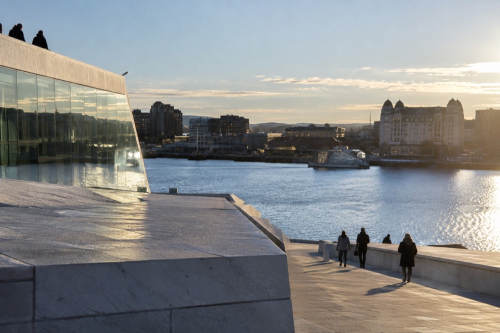
The single most useful mental map is a T-shape. The vertical stroke of the T is Karl Johans gate, the processional street that runs west from Oslo Central Station, past the Cathedral, the Storting, the National Theatre and up the slight rise to the Royal Palace at the far end. The horizontal stroke of the T is the waterfront: Rådhusbrygge 3 where the Bygdøy ferry leaves, Aker Brygge with its restaurants and the island ferry pier, the Tjuvholmen and Barcode districts, and the Opera House at the eastern end by Oslo S.
North of the palace the grid softens into Frogner, the old west-side residential quarter of embassies and the Vigeland sculpture park. South and east of the station the character shifts fast: Grünerløkka and Tøyen sit across the Akerselva, denser, younger, and where the city's food and bar life actually lives. The full Oslo neighborhoods guide breaks each of these quarters down individually.
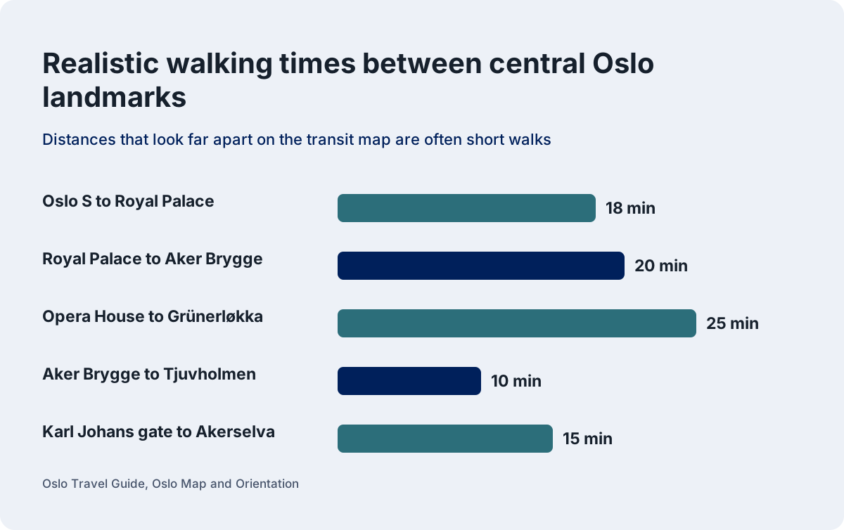
Distances that look far apart on a transit map are often a ten-minute walk. The National Theatre to the Opera House is about 15 minutes on foot. The Royal Palace grounds to Aker Brygge is under 20. The mistake visitors make is treating the T-bane map as a measure of distance, when in the center it is mostly a measure of laziness.
| Landmark pair | Realistic walk |
|---|---|
| Oslo S to Royal Palace | 18 min |
| Royal Palace to Aker Brygge | 20 min |
| Opera House to Grünerløkka | 25 min |
| Aker Brygge to Tjuvholmen | 10 min |
| Karl Johans gate to Akerselva | 15 min |
What Are the Main Areas of Oslo?
Oslo divides into a compact downtown core, the Sentrum, surrounded by named inner neighborhoods: Frogner and Majorstuen to the west, Grünerløkka and Tøyen to the east across the river, and the waterfront districts of Aker Brygge, Tjuvholmen and Bjørvika along the fjord. Bygdøy, the museum peninsula, sits across the water to the southwest, and the forest of Nordmarka closes over the whole city to the north.
Sentrum is where you will spend the first day whether you plan to or not: the station, the main street, the Cathedral, the City Hall and the harbor piers are all within a few blocks of each other. Karl Johans gate is the spine of it. West of the center, Frogner holds the Vigeland park, the highest concentration of older apartment blocks and, around Majorstuen, the junction where five tram lines and the metro's western branches meet before heading uphill.
East of the river the map changes character. Grünerløkka is Oslo's former workers' quarter turned into its most walkable eating and drinking district, strung along a grid north of the Old Town bridge. Tøyen holds the Botanical Garden and the MUNCH museum's Bjørvika neighbor is actually back toward the water, which is exactly the kind of thing a good map prevents you from getting wrong: MUNCH is on the waterfront in Bjørvika, while the Tøyen site was the old building.
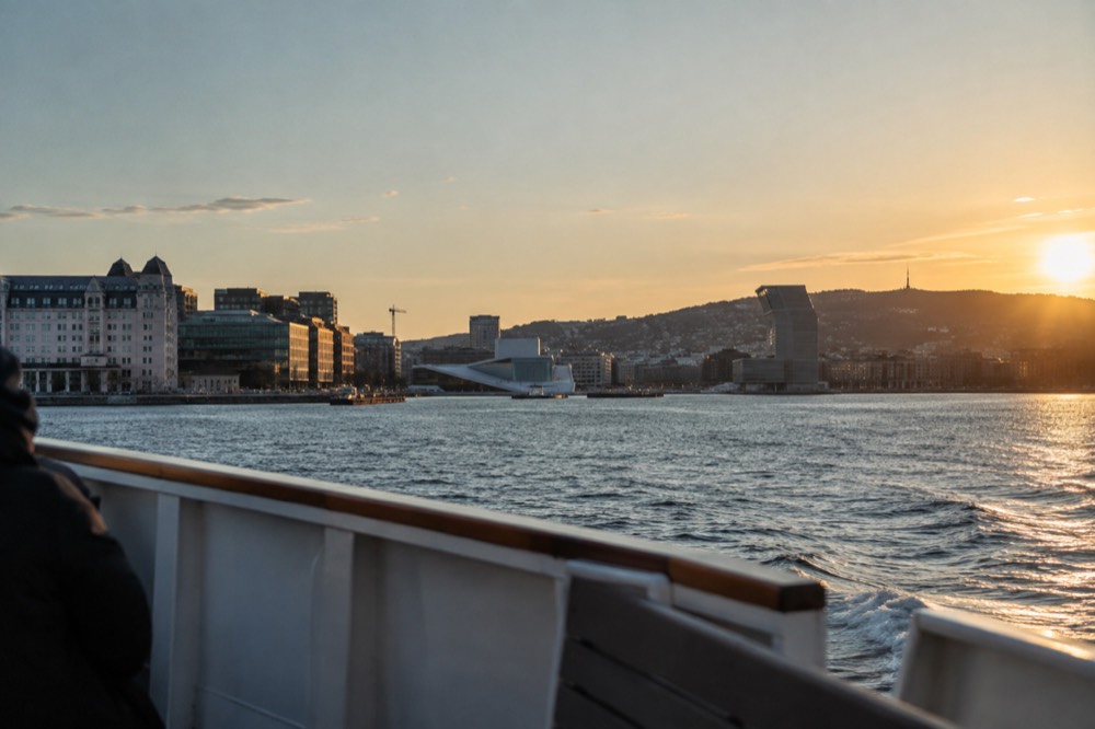
The waterfront itself reads left to right from a boat: Aker Brygge's converted shipyard wharf, then Tjuvholmen with the Astrup Fearnley museum on its canal point, then the Sørenga seawater pool, then around the point at the Opera House and into Bjørvika. Across the inner harbor to the southwest lies Bygdøy, the peninsula holding the Fram and Kon-Tiki museums and the open-air Folkemuseum. It is a 10 to 15 minute ferry ride from Rådhusbrygge 3 in season, or bus 30 year-round.
One honest note about the map's biggest trap: the Museum of the Viking Age on Bygdøy is closed for rebuilding until 2027, and it still appears on most printed tourist maps as though it were open. The Museum of the Viking Age page covers what is actually viewable in the meantime, which is the Viking-age collections at the Historical Museum in the city center.
Which Waterfront Pier Goes Where?
Oslo's harbor front uses two piers that visitors constantly confuse: Rådhusbrygge 3, from which the seasonal Bygdøy museum ferry leaves, and the Aker Brygge piers, from which the public Ruter island ferries B1, B1X and B2 leave. They are different operators with different ticket rules, and a Ruter ticket is not valid on the Bygdøy ferry, while the Oslo Pass covers both.
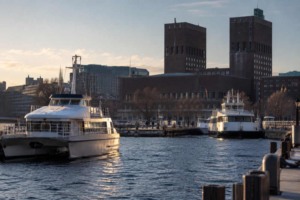
The geography is simple even if the ticketing is not. Rådhusbrygge 3, Platform F, is the City Hall pier, the first pier west of Akershus Fortress. The Bygdøy ferry runs from there seasonally, in 2026 from 14 March to 4 October, every 20 minutes, calling at Dronningen for the Folkemuseum and Bygdøynes for Kon-Tiki, Fram and the Maritime Museum. The operator states plainly that Ruter tickets are not valid on it; the Oslo Pass is.
The island ferries are ordinary public transport. Lines B1, B1X and B2 leave from Aker Brygge, a few hundred meters further west, and ride on a normal zone 1 ticket with no surcharge. They serve Hovedøya, Lindøya, Gressholmen, Bleikøya and Nakholmen year-round on B1, with the B2 to Langøyene running in summer. The Oslo ferries guide has the full seasonal timetable detail.
| Pier | Serves | Operator type | Ticket |
|---|---|---|---|
| Rådhusbrygge 3 | Bygdøy museums ferry | Private, seasonal | Oslo Pass or own fare |
| Aker Brygge | Islands B1, B1X, B2 | Ruter public lines | Ordinary Ruter ticket |
| Rådhusbrygge 4 area | Sightseeing cruises | Tour operators | Tour ticket |
The sightseeing boats, including the silent electric fjord cruise, leave from the central harbor piers between the two, which is why the whole waterfront reads as one confusing line of boats if you do not know which pier is which.
How Walkable Is Oslo Really?
The central rectangle of Oslo, from the Royal Palace to Oslo S and from the waterfront to the inner ring of Frogner and Grünerløkka, is genuinely walkable end to end in about 30 to 40 minutes, and most visitors can cover their entire first two days on foot. The exceptions are the hills: Holmenkollen, Nordmarka and the eastern ridges all sit far above and away from the core, and Bygdøy is a ferry or bus ride across the water.
Walkability is the reason this guide exists, because Oslo's transit map makes the city look bigger than it is. The T-bane's five lines fan out from a single shared tunnel under the center, so two stations that look far apart on the line diagram can be three minutes apart at street level. The metro is the tool for the hills, not the center. Line 1 to Frognerseteren at the edge of Nordmarka climbs over 400 meters in about 25 minutes from the National Theatre, which is the one metro ride worth taking for the view alone.
The slopes matter more than the distances. The center tilts gently up from the harbor, then rises sharply behind Frogner toward Holmenkollen, which sits on the northwest ridge. A walker heading from Majorstuen up to the ski jump is climbing for the better part of an hour. The Holmenkollen ski jump page covers the transport options, which are the honest answer for most visitors.
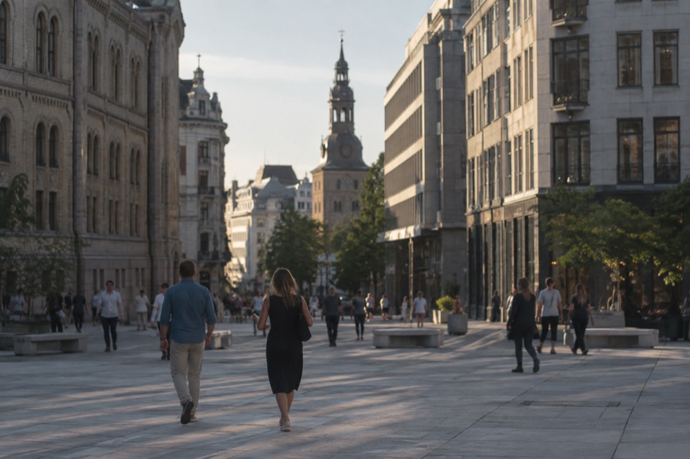
For the flat core, walking beats transit. The classic first-day loop, the Opera House, the harbor piers, City Hall, Karl Johans gate, the Royal Palace and back down through the University quarter, is a 5 km circuit that takes a slow afternoon and passes almost everything a first-timer has on the list. The Oslo walking route guide maps it turn by turn.
How Do the Transit Zones Work on the Map?
Oslo's public transport is zoned, with the entire city center and the whole metro network inside zone 1, and the airport at Gardermoen out in zone 4N, so a visitor staying central only ever needs a zone 1 ticket plus, on arrival and departure days, a ticket that also covers 4N. The Oslo Pass covers zones 1, 2, 3, 4V and 4N including the Vy airport trains, but not Flytoget.
The zone system is the part of the Oslo map that costs people real money when they get it wrong. Zone 1 is generous: it includes not just the downtown core but every T-bane station in the city, the tram network, the inner buses and the island ferries. A visitor staying anywhere in the neighborhoods described above is living inside zone 1. The airport is the exception, sitting in zone 4N at the far northern edge of the map, and the correct ticket for the airport run is a multi-zone Ruter ticket valid on the Vy regional trains, which take about 23 minutes against Flytoget's 20. More of these guides are collected on Oslo Travel Guide. More of these guides are collected on Oslo Travel Guide.
The Ruter tickets guide explains the fare structure in detail, and the Flytoget vs Vy comparison covers the airport decision specifically. The short version for orientation purposes: the map has one expensive line on it, the airport express, and everything else is ordinary zoned transit.
| Zone | What it covers | Who needs it |
|---|---|---|
| Zone 1 | Central Oslo, all T-bane lines, trams, inner buses, island ferries | Almost every visitor |
| Zone 2-3 | Inner Akershus suburbs | Rarely needed |
| Zone 4N | Gardermoen airport | Airport transfer days |
| Zone 4V | Western Akershus | Day trips west |
Where Does the River Fit Into the Map?
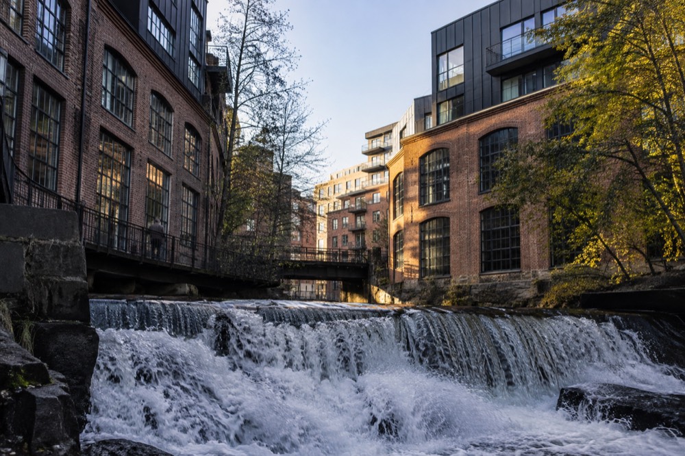
The Akerselva river runs roughly 8 km from the northern lake of Maridalsvannet down through the city to the harbor at Grønland, and it is the city's real east-west dividing line: west of the river is the older, wealthier, calmer Oslo, and east of it is Grünerløkka, Tøyen and Grønland, the denser, younger side. The riverside path itself is one of the best free walks in the city.
The river is the orientation feature nobody warns you about. It enters the map at the top in industrial-residential territory, drops past the waterfall at Mølla, runs the length of Grünerløkka's western edge with its converted mills, and empties into the harbor just east of the Opera House quarter. Crossing it, on foot or by tram, is the moment the city visibly changes character, from the embassies and galleries of the west to the bars and vintage shops of the east.
The path along it is a genuine attraction in its own right, an unbroken walking and cycling trail from the harbor to the forest edge, passing waterfalls, old factory buildings and the Mathallen food hall at the Vulkan complex. For orientation purposes the river gives you a free north-south axis: if you are standing on it, the harbor is downhill and the forest is uphill, which in Oslo is all the navigation you need.
How Do You Orient Yourself in Oslo in Winter?
In winter the same map applies but the daylight does not: Oslo swings from 18 hours 50 minutes of daylight at midsummer to 5 hours 53 minutes at midwinter, with the sun rising at 09:18 and setting at 15:11 on 21 December, so orientation in the dark months is about grouping your sights geographically rather than spreading them across the map. The city itself never closes, and the winter transport network runs the same zones and lines.
The daylight swing is the single most under-explained planning fact about this latitude, and it reshapes the map twice a year. In late June the sun sets at 22:43 and rises at 03:53, and the gap between is twilight rather than true night, so evening walks along the waterfront stay pleasant until nearly midnight. In late December the sun is up for under six hours, and a visitor who puts the Vigeland park in the morning, a museum at midday and Grünerløkka in the afternoon has spent their entire daylight budget on transit if the geography is wrong.
The fix is clustering. The Bygdøy museums are one ferry ride from one pier. The National Museum, the National Theatre and the Royal Palace sit in a single west-end cluster. The MUNCH museum, the Opera House and the Barcode district are one eastern waterfront cluster. The Oslo in winter guide covers the seasonal specifics, and the Oslo daylight hours page carries the full monthly table.
| Period | Sunrise | Sunset | Day length |
|---|---|---|---|
| 21 June | 03:53 | 22:43 | 18 h 50 m |
| 15 Aug | 05:31 | 21:09 | 15 h 38 m |
| 15 Oct | 07:55 | 18:08 | 10 h 13 m |
| 21 Dec | 09:18 | 15:11 | 5 h 53 m |
What Should You See First to Get Your Bearings?
The fastest way to fix Oslo's geography in your head is to take a boat out on the fjord, because the one axis you cannot walk is the water, and 90 minutes on a silent electric cruise from the central harbor shows you the entire southern edge of the city, from Aker Brygge past Bygdøy to the island chain, in a single loop with the hills of Nordmarka lined up behind. After that, walk Karl Johans gate end to end and you have both reference lines of the map.
The electric boat is the orientation tool disguised as a tour. From the water the city's shape becomes obvious: the compact center stacked against the harbor, the museum peninsula off to the southwest, the low green islands strung across the fjord mouth, and the forest wall behind everything. The audio guide narrates what you are looking at, which is exactly what a first-day visitor needs before committing to a walking plan.
The land-based equivalent is the free highlights walking tour, which covers the central rectangle in about two hours on a tip basis and doubles as a live orientation session. The Oslo free walking tours guide compares the options. For a self-guided version, the one day in Oslo itinerary is already sequenced geographically west to east so that no leg of it backtracks.
What Distances Should You Actually Plan Around?
The distances that matter in Oslo are short in the center and long at the edges: the downtown rectangle is a short stroll across, Bygdøy is a 10 to 15 minute ferry or a 15 minute bus ride from the National Theatre, the forest edge at Frognerseteren is a 25 minute metro climb, and the airport is 50 km north of the center entirely off the walking map. Plan your days around clusters, not around individual pins.
The numbers below are the ones worth taping to the inside of your itinerary. They are the difference between a relaxed day and a day spent watching departure boards.
| Trip | Time | Method |
|---|---|---|
| Center to Bygdøy museums | 10-15 min | Ferry from Rådhusbrygge 3, or bus 30 |
| Center to Grünerløkka | 25 min walk, 10 min tram | Trams 11, 12, 13 or buses |
| Center to Vigeland Park | 30 min walk, 10 min tram | Tram 12 or T-bane to Majorstuen |
| Center to Frognerseteren | ~25 min | T-bane Line 1 |
| Center to Gardermoen airport | ~20-23 min | Flytoget or Vy train |
| Center to island beaches | 10-20 min | Ruter ferries from Aker Brygge |
The airport row deserves its own sentence because it is where the map and the money intersect: the Vy regional train takes about 23 minutes to Oslo S and costs roughly half the airport express fare, and a Ruter ticket covering zone 1 through 4N is valid on it. The Oslo airport to city centre guide works through the full decision.
Common Questions About Oslo Map and Orientation
How is Oslo laid out on the map?
Oslo sits in a bowl at the head of the Oslofjord, with a compact downtown core pressed against the water. The center runs from Oslo Central Station to the Royal Palace along Karl Johans gate, with Frogner to the west, Grünerløkka and Tøyen east of the Akerselva river, and the museum peninsula of Bygdøy across the harbor to the southwest.
Is Oslo walkable for tourists?
Yes, in the center. The core rectangle from the Royal Palace to the station and the waterfront to the inner neighborhoods is walkable end to end in 30 to 40 minutes. The exceptions are the hills of Holmenkollen and Nordmarka, the Bygdøy peninsula across the water, and the airport 50 km north.
Which pier do the Bygdøy and island ferries leave from?
The Bygdøy museum ferry leaves from Rådhusbrygge 3 by City Hall and is a private seasonal service where Ruter tickets are not valid. The island ferries B1, B1X and B2 leave from Aker Brygge and are ordinary Ruter public transport, covered by a standard zone 1 ticket.
What transit zone is central Oslo in?
Central Oslo, including the entire metro network, the trams and the island ferries, is inside zone 1. Gardermoen airport is in zone 4N. A visitor staying central only needs a zone 1 ticket, plus a multi-zone ticket or an Oslo Pass on airport days.
What is the east-west dividing line in Oslo?
The Akerselva river. West of it lie the older, calmer quarters like Frogner and Majorstuen; east of it are Grünerløkka, Tøyen and Grønland, the denser and younger side of the city. The riverside path is a continuous walking trail from the harbor to the forest edge.
Does the map change in winter?
The geography does not, but the daylight does. Oslo swings from 18 hours 50 minutes of daylight in June to 5 hours 53 minutes in December, so in the dark months you should cluster sights geographically rather than spreading them across the city.