Hovedøya: The Abbey Island in the Oslofjord
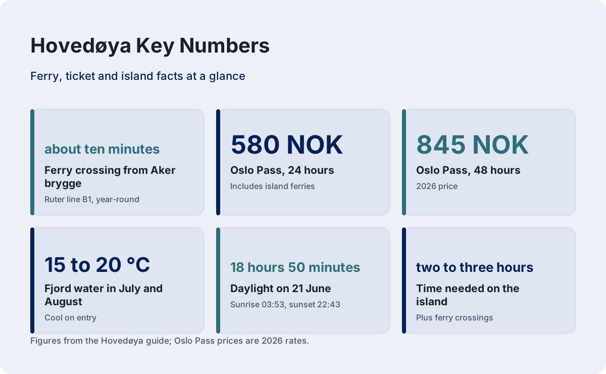
Hovedøya is the closest island in the Oslofjord to the city center, a ten-minute ferry ride from Aker brygge, and it packs a ruined medieval monastery, swimming coves and forest paths into a walkable pocket of green.
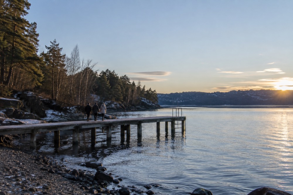
Short answer
Hovedøya is a small forested island 10 minutes by ferry from Aker brygge, covered by an ordinary Ruter zone 1 ticket and by the Oslo Pass. Its headline sight is the ruined Cistercian abbey, and it is one of the most popular swimming and picnic islands in the Oslofjord.
Hovedøya sits so close to central Oslo that you can see the Barcode towers from its western shore, yet the moment the ferry pulls away from Aker brygge the city goes quiet and the island takes over. This is the island most Oslo residents mean when they say "out on the fjord" for an afternoon: a ruined Cistercian abbey, swimming coves, forest paths and enough lawn for a picnic, all inside an ordinary Ruter zone 1 ticket. That last detail matters more than it sounds, because the ferry to Hovedøya is a public transport line, not a tourist cruise, and it is one of the cheapest half-days out in a city where the cost question is real. This page covers how to get there, what to do, and how to plan the trip, with the practical details most guides blur.
What Is Hovedøya and Why Is It Worth a Visit?
Hovedøya is the nearest of the Oslofjord islands to the city center, roughly ten minutes by public ferry from Aker brygge, and it combines a ruined medieval Cistercian abbey with forest, meadows and swimming spots on a small, walkable island. It costs no more than an ordinary Ruter ticket, which makes it one of the genuinely inexpensive half-days in Oslo.
The island is small enough that you will not get lost and big enough to fill two or three unhurried hours. The abbey ruins sit near the center, surrounded by trees; the shoreline alternates between smooth granite, grassy slopes and small coves that fill with swimmers on warm summer days. Because the ferry is a scheduled Ruter service, you can come and go on the same ticket logic you use for a tram, within the ticket's validity window.
What surprises most first-time visitors is how residential-scale the whole thing feels. You are not on a wilderness expedition; you are on a municipal island with a kiosk in season, maintained paths and a ferry every twenty minutes or so in summer. That is exactly the appeal. Oslo is one of very few capitals where an island with ruins and swimming is a normal Tuesday-evening trip, and Hovedøya is the most accessible example of it.
The island is also a good answer to the question of what to do in Oslo for free or nearly free, which this site treats as a serious planning category rather than an afterthought. The ferry fare is the only mandatory cost, and everything on the island itself, the ruins, the paths, the swimming, costs nothing. If you are building a budget day, pair it with the free Vigeland sculpture park, which is open around the clock with no ticket at all.
For the fuller picture of the archipelago, see the site's guide to Oslo's islands, which compares Hovedøya with Gressholmen, Langøyene and the smaller islets.
How Do You Get to Hovedøya from Central Oslo?
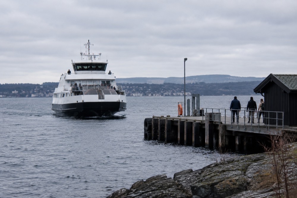
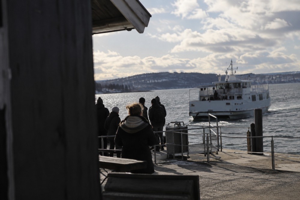
Take the Ruter island ferry from Aker brygge: line B1 runs year-round and calls at Hovedøya, with the crossing taking about ten minutes. An ordinary Ruter zone 1 ticket covers the ferry, and the Oslo Pass covers it too. Do not go to Rådhusbrygge 3, that pier serves the Bygdøy museum ferry, a completely different service with different ticket rules.
The two-pier confusion is the single most common mistake visitors make with Oslo's boats, so it deserves its own clear statement. The island ferries, lines B1, B1X and B2, depart from the Aker brygge side of the harbor. The Bygdøy ferry departs from Rådhusbrygge 3 near City Hall and is run by a separate operator; Ruter tickets are not valid on it, though the Oslo Pass is. If you have a Ruter ticket in your app and you board at the wrong pier, you are on the wrong boat in both directions of the word.
| Ferry line | Serves | Season | Frequency |
|---|---|---|---|
| B1 | Hovedøya, Lindøya, Gressholmen, Bleikøya, Nakholmen | Year-round, reduced off-season | Regular daytime service, densest in summer |
| B1X | Aker brygge and Hovedøya only | Summer extra | Every 20 minutes at peak |
| B2 | Hovedøya, Gressholmen, Langøyene | Mainly May to September | Seasonal timetable |
Ruter's own ferry page publishes the seasonal timetables, and the summer and autumn schedules swap over in the course of the season, so check the app or the Ruter journey planner on the day you travel rather than trusting a cached timetable. A single ticket for one zone is valid for 60 minutes from activation, which is enough to reach the island but not to come back on the same ticket; a day ticket or the Oslo Pass is the relaxed option if you plan to hop between islands.
One more planning note that saves real money: the Oslo Pass, at 580 NOK for 24 hours and 845 NOK for 48 hours in 2026, includes Ruter public transport in zones 1, 2, 3, 4V and 4N, and that explicitly includes the island ferries. Three or four ferry hops plus a museum or two and the pass pays for itself. The details are laid out in the site's Oslo ferries guide.
If you would rather see the fjord from a boat with commentary than from a commuter ferry, the sightseeing side of the Oslofjord is well covered too, and the choice between the formats is genuinely worth thinking through before you book anything.
The silent electric fjord cruise is the single best-reviewed activity in Oslo, and the island-hopping tour is the guided version of exactly the trip this page describes. The wooden sailing ship is the third format, a two-hour sail on a traditional vessel rather than a ferry or a modern boat. Which one suits you depends on whether you want to land on the islands or see them from the water.
What Is There to Do on Hovedøya?
The three main draws are the ruined Cistercian abbey at the island's heart, the swimming coves and granite shoreline around the edges, and the network of forest and meadow paths between them. Most visitors combine all three in a slow loop that takes one to three hours, plus whatever time you spend swimming or picnicking.
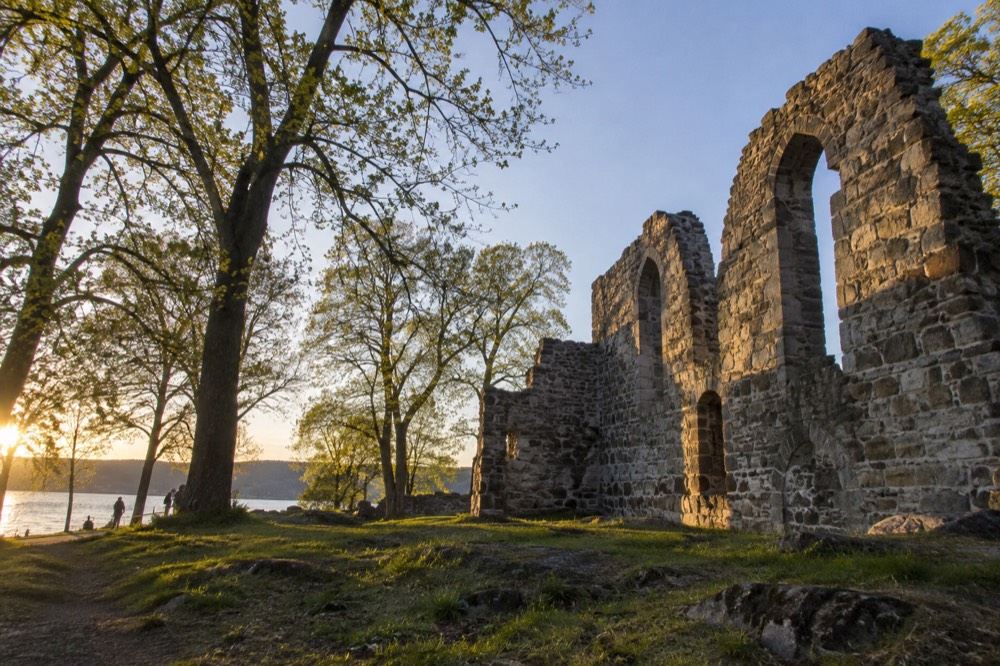
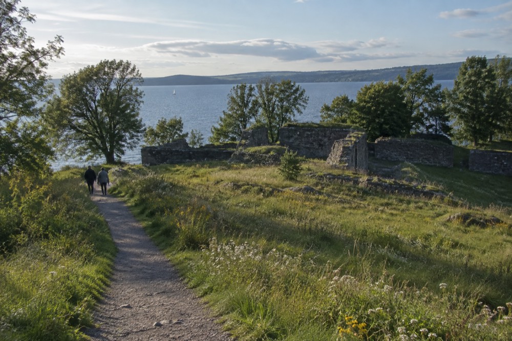
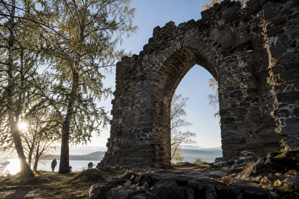
Start with the ruins, because they are the reason the island has a name in the guidebooks at all. The abbey walls stand open to the sky, roofless and quiet, and you can walk around and through them freely. There is no ticket, no gate and no queue. The setting does most of the work: stone walls against birch and pine, with the fjord visible through the trees. Photography-minded visitors will find the ruins and the western shoreline among the better close-to-center subjects in the city.
Then work the shoreline. The island's coves fill up on warm July and August days, and the water in the Oslofjord in high summer typically sits in the 15 to 20 °C range, cool rather than warm, which is normal for this latitude and this body of water. There are no lifeguards and no chlorine; this is sea swimming off rocks and small beaches, and locals treat it as such. Bring a towel and something to sit on, because the granite gets hot in full sun.
| Activity | Where on the island | Time needed | Cost |
|---|---|---|---|
| Abbey ruins | Center of the island | 20 to 40 minutes | Free |
| Swimming | Coves on the shoreline | As long as you like | Free |
| Forest and meadow paths | Throughout | 45 to 90 minutes for a loop | Free |
| Picnic | Lawns near the pier and the ruins | Flexible | Free, bring your own |
| Island hopping onward | Pier | Ferry waiting time | Ruter ticket or Oslo Pass |
The paths deserve more credit than they get. The island is wooded enough that you can lose sight of the city entirely on the eastern side, and the terrain is gentle, nothing that requires boots or a map. Families manage it easily, and the whole loop is manageable with children in the mix. If you are traveling with kids, the island pairs naturally with the suggestions in Oslo with kids, which covers the city's more child-forward sights.
A seasonal kiosk near the pier sells the basics in summer, but do not build a plan around it; hours are short and the season is real. The safe move is to buy what you want in the city before boarding. And note that Norway's alcohol rules apply on the island as everywhere else: supermarkets sell beer only, up to 4.7% ABV, and wine and spirits come solely from Vinmonopolet, which is closed on Sundays. A picnic on Hovedøya is a sandwich-and-cider proposition unless you plan ahead.
If your interest is less the island itself and more a guided walk through the whole archipelago, the ferry-and-foot island hopping tour is the strongest version of that, and it is worth a look before you commit to doing it all yourself.
The guided option does not replace the do-it-yourself ferry trip described above; it packages it. If you have a full day and want the logistics handled, it is a strong choice. If you have an afternoon and a Ruter app, the public ferry is the honest budget answer, and no tour is required to stand inside the abbey walls.
For visitors who decide to add a water leg to the same day, the question becomes which boat, and the silent electric cruise is the one most first-timers land on. It runs ninety minutes with an audio guide, it is the most-reviewed activity in the city, and it departs from the same harbor you will already be standing in for the island ferry.
Can You Swim on Hovedøya, and Is the Water Cold?
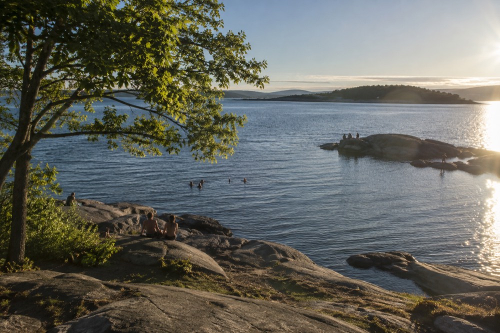
Yes, swimming on Hovedøya is free, unsupervised and popular, with small coves and flat granite entry points around the shoreline. The water in the Oslofjord in July and August typically runs 15 to 20 °C, which feels cool on entry and pleasant after a minute, and there are no pools or chlorinated facilities on the island.
The swimming here is the same swimming as at the city's official bathing spots like Sørenga and Tjuvholmen on the mainland: sea water, tested by the municipality, entered from rocks or small beaches. Oslo kommune publishes bathing water quality results and temperatures for its official sites, and yr.no carries current conditions; on a hot day, checking the temperature before you commit to a swim is a two-minute job that saves a bracing surprise.
What Hovedøya offers over the mainland spots is space and quiet. The Sørenga seawater pool can feel like a city beach in every sense, crowded and concrete-framed. The island's coves, even on a busy Saturday, spread people out along the shoreline, and the setting, trees behind you and fjord in front, is the more Norwegian of the two experiences. The trade is facilities: fewer toilets, no lifeguard, and a ferry timetable between you and dry clothes.
If swimming is the main point of your trip, compare Hovedøya with Langøyene, the island specifically known for its beaches and for free tent camping of up to two nights in season. Langøyene is served by the seasonal B2 line, so it needs a bit more planning, and the camping option makes it an overnight proposition rather than an afternoon one. The comparison between the islands is laid out in the Langøyene guide.
One caution worth stating plainly: the ferry stops running in the early evening, and the timetable thins outside the summer peak. An evening swim that runs long can turn into a cold wait for the last boat. Check the last departure on the day you go, not the day before.
What Is the Story Behind the Abbey Ruins?
The ruins on Hovedøya are the remains of a medieval Cistercian monastery, one of the significant monastic sites in the Oslo region, left roofless and open to the sky. The walls stand free to walk around, with no ticket, no gate and no opening hours, and they are the island's main historical sight.
The Cistercian order ran monasteries on austere, self-sufficient lines, and island sites suited that discipline: water on every side, separation from the town, land for grazing and gardens. What you see today is the stone skeleton of that arrangement, and the setting has changed far less than the buildings have. The forest has grown up around the walls, and the fjord is exactly where it was. Other pages covering the same trip are gathered on Oslo Travel Guide. Other pages covering the same trip are gathered on Oslo Travel Guide.
This site deliberately does not supply founding dates, abbots' names or a construction timeline for the ruins, because none of those details were verified against a primary source in this site's research pass. Plenty of guides print confident medieval dates for Hovedøya's abbey; this site's policy is that a year, a century or an attribution must come from a verified source or not be written at all. The ruins are worth your twenty minutes without a date attached.
For visitors whose main interest is Oslo's history rather than its outdoors, the honest framing is this: Hovedøya is a pleasant half-day with a ruin in the middle, not a museum. If you want Oslo's curated history, the city's museum cluster does that job properly, and the Oslo museums overview maps the options, from the National Museum in the center to the Fram and Kon-Tiki museums on Bygdøy.
One historical note that does matter practically: the Viking Ship Museum on Bygdøy remains closed and will reopen as the Museum of the Viking Age in 2027, per the museum's own wording. Do not build a Bygdøy-plus-islands day around it. Viking Planet, with a VR movie included in the ticket, is the bookable Viking experience in the meantime.
How Much Time Do You Need, and When Is the Best Time to Go?
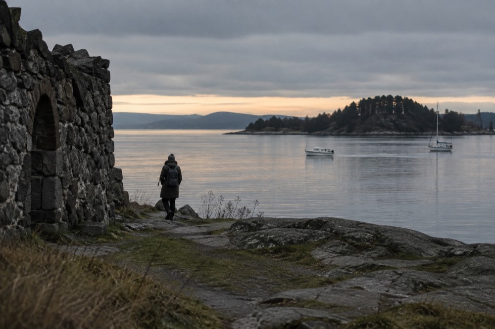
Plan on two to three hours on the island itself, plus the ferry crossings, making it a half-day trip in practice. The best months are May through September, when the trees are in leaf, the kiosk has a chance of being open and swimming is realistic; the ferry runs year-round on line B1, but winter visits are short, cold and mostly about the walk.
Midsummer is the peak, and it comes with a specific Oslo advantage: on 21 June the sun rises at 03:53 and sets at 22:43, giving 18 hours 50 minutes of daylight, and the evenings stay light rather than dark. An after-work ferry to the island in June is a genuinely local move. There is no midnight sun in Oslo, the city is at 59.91 N, well south of the Arctic Circle, but late-June twilight means the last ferries run in daylight.
| Period | Daylight (15th of month) | Island conditions | Verdict |
|---|---|---|---|
| January | 6 h 45 m | Bare trees, cold, short window | Only for a brisk walk |
| April | 14 h 34 m | Spring green, quiet paths | Good, water too cold for most |
| July | 18 h 02 m | Full summer, swimming, busiest | The classic visit |
| September | 12 h 54 m | Late-season calm, first yellow leaves | A quiet favorite |
| December | ~6 h | Dark early, ferry thins out | Skip unless local |
Weather planning matters more here than on a museum day, because the whole trip is outdoors. August is Oslo's wettest month on the 1991 to 2020 normals at 103 mm, ahead of November, which surprises most visitors who assume autumn is the wet season. July's normal mean of 17.7 °C is mild rather than hot. If the forecast turns, the site's rainy day in Oslo guide is the pivot page, and the Paradox Museum ticket is the strongest indoor family option in the roster.
For combining the island with the rest of a first trip, the itinerary pages are the right starting point: one day in Oslo is tight for an island add-on, while 3 days in Oslo absorbs it comfortably as a summer afternoon block.
What Should You Bring, and What Are the Practical Rules?
Bring a towel and swimwear in summer, water and snacks, and layers for the ferry ride home; there is no shop you can rely on, no lifeguard, and no equipment rental on the island. The practical rules are simple: ordinary Ruter ticketing on the ferry, no camping on Hovedøya (that is Langøyene's role), and the last departure time is the one detail that can ruin your day.
Camping is worth a specific sentence, because the islands are often discussed as a group and the rules differ. Langøyene allows free tent camping for up to two nights in season; Hovedøya is a day-trip island. If an overnight on an island appeals, plan for Langøyene and the seasonal B2 line, not this one.
Fires and grilling are restricted on the municipal islands, and the rules are enforced rather than theoretical; check current signage on the island before lighting anything. Rubbish bins are limited and the norm in Norway is to carry out what you carry in. The island is small and the ferry is frequent, so none of this is burdensome, but it is the difference between a good visit and a fine.
| Item | Bring it? | Why |
|---|---|---|
| Towel and swimwear | May to September | Sea swimming from rocks and coves |
| Water and food | Always | Kiosk is seasonal and short-hours |
| Warm layer | Always | Ferry ride home is exposed to the wind |
| Cash | No | Ruter app or card covers everything |
| Sturdy shoes | Optional | Paths are gentle; sandals work in dry weather |
| Power bank | Optional | Photos, maps and the Ruter app all drain a phone |
Accessibility is a fair question and the honest answer is partial. The area around the pier and the nearest lawns are manageable for strollers and wheelchairs in dry weather, but the paths beyond that are unpaved, rooty in places, and the swimming coves involve granite. The site's Oslo accessibility guide covers the city's more reliably accessible options, and the chauffeured private car tour in the tour roster is the strongest all-inclusive alternative for visitors who cannot manage unpaved ground.
For transport fundamentals beyond the ferry, including the airport train question that trips up so many itineraries, the getting around Oslo page is the hub. The one fact worth repeating anywhere near the subject: the Oslo Pass covers the Vy train to and from Gardermoen but not Flytoget, which is a separate company at 268 NOK for an adult single.
Should You Pair Hovedøya with a Fjord Cruise?
Pairing the island with a sightseeing cruise works well as a one-day fjord plan: the ferry-and-foot island tour or a self-guided ferry trip in the afternoon, and a silent electric or wooden-ship cruise as the bookend. The two formats show you different things, the islands from inside and the fjord from the water, and they share the same harbor geography.
The decision is mostly about time and format. If you have one full day and want the archipelago handled end to end, the guided island-hopping tour covers the ferry-and-foot structure with a guide attached. If you would rather spend ninety minutes on the water with commentary and keep the afternoon free, the silent electric cruise is the default first booking in Oslo, with the best review profile of any activity in the city. The wooden sailing ship is the same fjord at a slower, more traditional pace, and the shrimp-buffet evening cruise turns the whole thing into a dinner outing.
Whichever you choose, book the sightseeing leg before you finalize the ferry plan, because cruise departures are fixed and the public ferry is flexible. A morning cruise and an afternoon on Hovedøya, or the reverse, is the shape most visitors land on, and both directions work with the B1's frequency.
The two-hour wooden-ship sail is the contrast pick of the three: same fjord, completely different vessel, and a format that photographs nothing like the electric boats. It suits visitors who want the maritime feel rather than the quiet-modern one.
And if the whole fjord subject has outgrown this page, the deeper cruise-by-cruise comparison, including the dinner boat and the full-day five-island option, lives in the site's Oslofjord cruise guide, with the sibling site oslofjordcruises.com covering the fjord region in depth beyond the city.
For the electric-boat version, the numbers do most of the arguing: it is the single best-reviewed activity in Oslo, a ninety-minute loop with audio commentary, and it shares a harbor with the island ferry you are already using. Visitors who book one thing for an Oslo trip tend to book this one.
Between the electric boat, the wooden ship and the guided island walk, the trio below covers the three honest ways to see this same stretch of water. Pick by format, not by price, because all three sit in the same band and the experience differs more than the fares do.
Common Questions About Hovedøya
How do I get to Hovedøya?
Take the Ruter island ferry from Aker brygge: line B1 runs year-round and calls at Hovedøya, with the crossing taking about ten minutes. An ordinary Ruter zone 1 ticket covers the ferry, and the Oslo Pass covers it too. Do not go to Rådhusbrygge 3, that pier serves the separate Bygdøy museum ferry, on which Ruter tickets are not valid.
Is Hovedøya free to visit?
The island itself is completely free: the abbey ruins, the paths and the swimming cost nothing. The only mandatory cost is the ferry fare, which is an ordinary Ruter zone 1 ticket, the same as a tram ride, and the Oslo Pass covers the ferry outright.
Can you swim on Hovedøya?
Yes. Swimming is free, unsupervised and popular, from small coves and flat granite around the shoreline. Oslofjord water in July and August typically runs 15 to 20 °C, cool rather than warm, which is normal for this latitude. There are no lifeguards and no pools, so it is sea swimming, entered from rocks.
How long does a visit to Hovedøya take?
Plan on two to three hours on the island plus the ferry crossings, making it a half-day trip. The abbey ruins take 20 to 40 minutes, a full path loop takes 45 to 90 minutes, and swimming or a picnic extends the visit as long as you like, bounded only by the last ferry departure.
Can you camp on Hovedøya?
No. Hovedøya is a day-trip island. Free tent camping for up to two nights in season is a Langøyene thing, reached on the seasonal B2 ferry line. If an island overnight is the plan, aim for Langøyene and check the B2 timetable first.
What is the ruin on Hovedøya?
The ruin is a medieval Cistercian abbey, roofless and open to walk around freely, with no ticket, gate or opening hours. It is the island's main historical sight and the reason Hovedøya appears in most guides. This site does not print founding dates for it, because none were verified against a primary source.