Hiking Near Oslo: Trails, Seasons and How to Reach Them Without a Car
Oslo is one of very few capitals where a groomed forest trail sits at the end of a metro line. Here is what the hills around the city actually offer, season by season, and how to reach every trailhead without renting a car.
Short answer
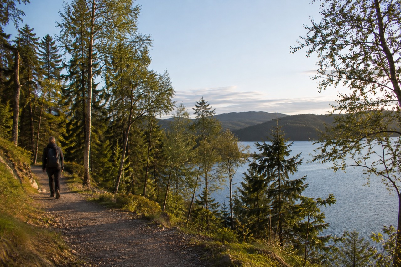
The best hiking near Oslo sits in Nordmarka, the forested hills reached by metro Line 1 to Frognerseteren in about 15 to 20 minutes from the center, and on the Oslofjord islands, reached by Ruter ferry from Aker brygge on an ordinary zone 1 ticket. Trails are free, marked and maintained by Skiforeningen, which publishes live trail and snow-depth reports.
Where Can You Hike Near Oslo Without a Car?
The hiking around Oslo splits into two reachable worlds: Nordmarka, the huge forested hill mass on the city's northern edge, and the Oslofjord islands, a short ferry ride from the center. Nordmarka is reached by the T-bane, most famously Line 1 to Frognerseteren, roughly 15 to 20 minutes from Nationaltheatret. The islands are reached by Ruter's B1 and B2 ferries from Aker brygge, on an ordinary ticket. Neither requires a car, a tour or a booking.
That second sentence is the one that surprises most visitors. In most European capitals, "hiking near the city" means a train ride, a bus connection and a compromise. In Oslo the forest genuinely starts where the metro stops, and the trail network is maintained the way a ski resort maintains its pistes, because in winter it is one.
The reason is geography and municipal ownership. The city sits at the northern end of the Oslofjord with the Marka forests, Nordmarka being the largest, draped over the hills above it, and the whole belt is protected and managed for recreation. Skiforeningen, the association that grooms the winter trails, publishes live trail and snow-depth reports on its own site, which are worth checking before any winter walk. Our guide to Nordmarka covers the forest in depth, and Sognsvann deserves its own page as the most popular entry point.
This article is the decision layer: which trailhead for which kind of day, what each season gives you, and when a guided option earns its price.
What Does Nordmarka Actually Offer a Day Hiker?
Nordmarka offers hundreds of kilometers of marked forest trails across hills, lakes and ridges, all inside the Oslo city limits, with the practical consequence that an ordinary Ruter ticket covers the journey to the trailhead. The terrain is rolling rather than alpine, the trails are color-coded and well signed, and the forest is a working recreational landscape, with prepared trails in winter and cafe huts along the main routes in summer. It is a half-day or full-day destination, not a expedition.
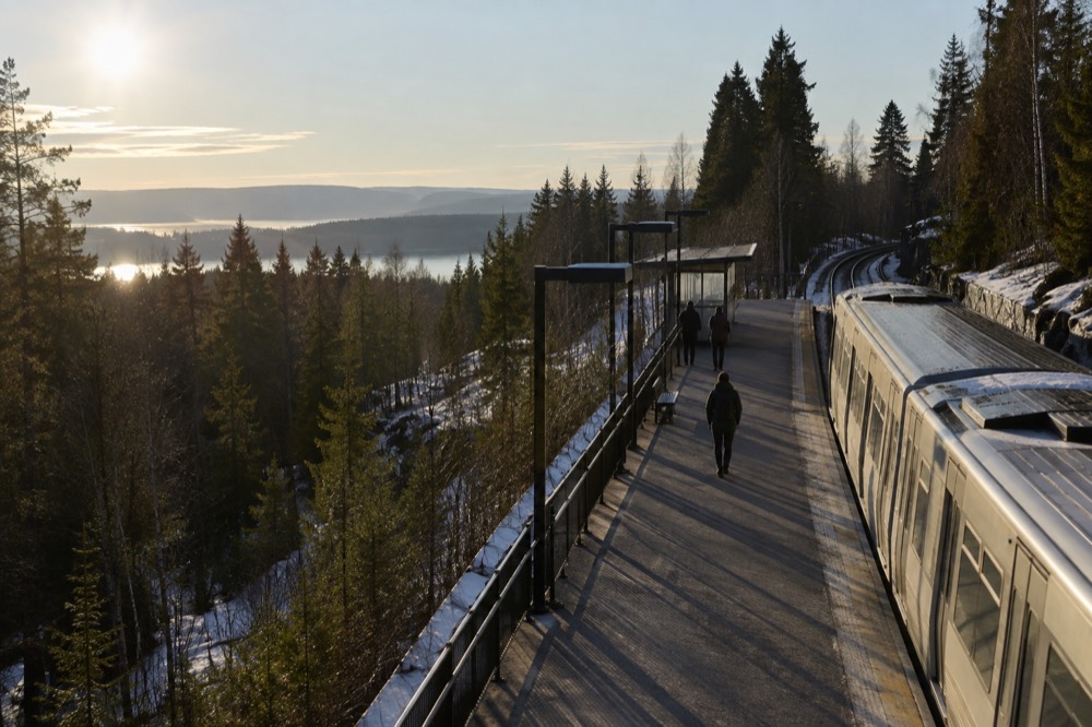
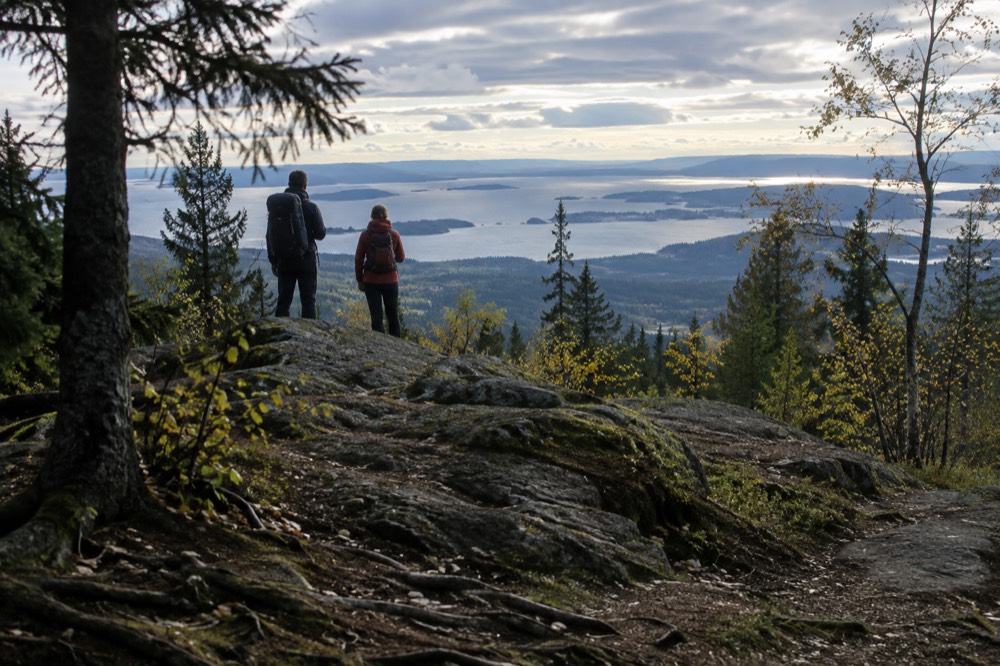
Line 1 of the T-bane is the classic approach. It terminates at Frognerseteren, high on the hillside above the city, from where trails drop and climb through the forest and the view back over Oslo and the fjord opens between the trees. Holmenkollen, a few stops earlier on the same line, is the other main gateway, and it comes with the ski jump as a landmark you cannot miss. Both stops sit roughly 15 to 20 minutes from Nationaltheatret in the center.
The forest is not wilderness in the Norwegian west-coast sense. It is bilberry heath, spruce and pine, lakes with swimming spots in summer, and a dense web of paths that make loop walks easy to improvise. What it offers a visitor is scale: you can walk for hours and still be back in the city for dinner, which is exactly what the one day in Oslo visitor usually wants from a half-day outdoors.
If you would rather have the trail, the view and the lunch handled for you, a guided option exists, and it is a strong one.
The first of those three is the one this article keeps coming back to: a fjord-view forest hike with a chef-cooked waffle stop, rated a perfect 5.0 across 211 reviews. The other two cover the seasons and the format the hike does not: a torchlit winter forest walk with a campfire, and a packraft or kayak trip down the Akerselva river through the middle of the city. Between them, most visitors' constraints are covered.
Which Easy Trails Work for a First Visit?
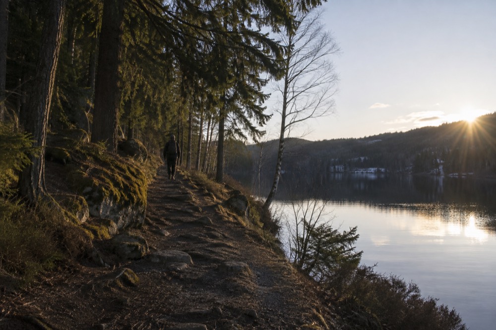
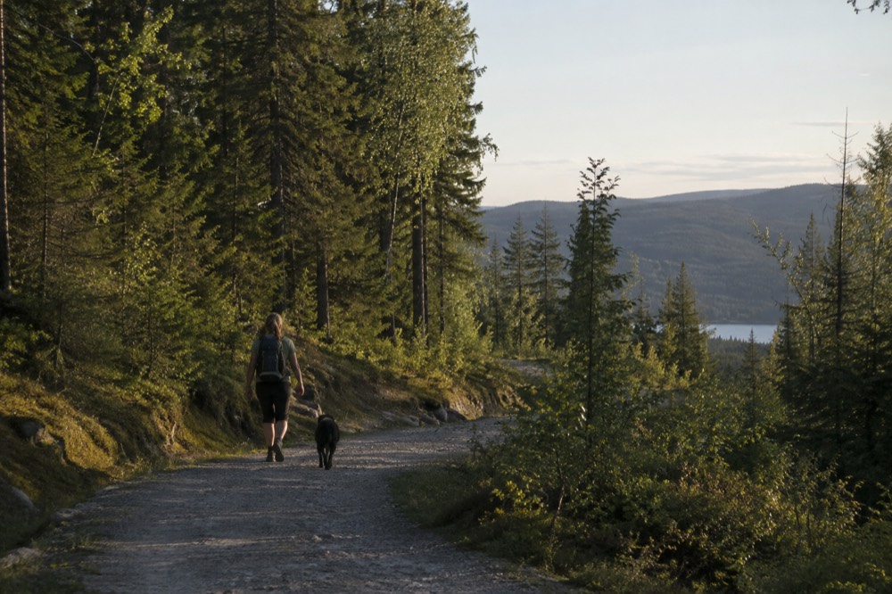
For a first walk, use Frognerseteren as the trailhead and follow the marked paths downhill or along the ridge, because it combines the biggest views with the easiest navigation and a metro station at both the start and, if you plan a loop, near the end. Sognsvann is the other beginner default: a lake-centered forest area that is Oslo's most popular outdoor entry point, flat around the water and family-friendly. Both are free, both are open year-round, and neither needs a guide.
The honest framing is that Oslo's easy walking is not really about named signature trails, the way a national park would market them. It is about trailheads. Pick the trailhead, and the paths from it sort themselves out, with color-coded markings and distances on the signposts.
The table below is the practical access picture for the main gateways, using the transport facts that are actually verified. Note the two different boat systems if you add islands to a forest day: the Bygdøy museum ferry is a separate operator that does not take Ruter tickets, while the island ferries do.
| Gateway | How to get there | What it gives a hiker |
|---|---|---|
| Frognerseteren | T-bane Line 1, about 15 to 20 min from Nationaltheatret | High starting point, ridge and lake trails, views back over the city and fjord |
| Holmenkollen | T-bane Line 1, same line, earlier stop | Forest paths plus the ski jump and its museum as a landmark |
| Sognsvann | T-bane, then a short walk from the station | Lake loops, flat terrain, the most family-friendly entry |
| Oslofjord islands | Ruter ferry B1 or B2 from Aker brygge, ordinary ticket | Coastal paths, swimming coves, abbey ruins on Hovedøya |
One warning that belongs in this section because it is where it bites: the Oslo Pass covers the island ferries and the T-bane, but it does not cover the Bygdøy museum ferry, which is a different operator with different rules. If your hiking day includes a museum stop on Bygdøy, check which boat you are actually boarding.
What About Hiking the Oslofjord Islands?
The Oslofjord islands give you coastal hiking with ruins, beaches and swimming, reached by public ferry from Aker brygge on an ordinary Ruter ticket or an Oslo Pass, with no booking and no surcharge. Hovedøya, closest to the city, has the ruined Cistercian abbey and short woodland paths. Langøyene, on the summer-only B2 line, is the swimming and camping island. Gressholmen and the smaller islands sit between them, quiet and low.
This is the Oslo-specific version of a hike, and it is the one that genuinely does not exist in most cities. The B1 line runs year-round on a circle route calling at Hovedøya, Lindøya, Gressholmen, Bleikøya and Nakholmen. The B2, which adds Langøyene, is seasonal, and the summer timetable runs 4 July to 30 August with an autumn timetable to 18 October. Check the current schedule in the Ruter app before you commit a day to it.
The islands are small, so think of it as island hopping rather than a single long route: a morning on Hovedøya's paths and abbey ruins, a ferry hop, an afternoon on a beach. Our Oslo islands page covers each island in detail, and Hovedøya has its own guide.
| Ferry line | Islands served | Season | Ticket |
|---|---|---|---|
| B1 | Hovedøya, Lindøya, Gressholmen, Bleikøya, Nakholmen | Year-round, reduced frequency off-summer | Ordinary Ruter ticket or Oslo Pass |
| B1X | Aker brygge to Hovedøya, every 20 minutes | Summer extra | Ordinary Ruter ticket or Oslo Pass |
| B2 | Hovedøya, Gressholmen, Langøyene | Summer timetable 4 July to 30 August 2026 | Ordinary Ruter ticket or Oslo Pass |
If you would rather have a whole island day organized, there is a full-day, five-island boat tour that covers the archipelago in about six hours, with the walking built in. It is a different product from the do-it-yourself ferry version, and the trade-off is simple: less flexibility, no timetable to read, and someone else watching the clock.
Whichever way you do the islands, the same rule of thumb applies as in the forest: the ferry is the hard part, and the walking takes care of itself. If the weather turns, the islands are also the more forgiving choice, because a ferry ride in drizzle is a minor loss while a ridge walk in it is a wasted afternoon. On a clear summer day, though, do both halves of this article in one trip if your legs are up for it: a morning in Nordmarka and an evening on Hovedøya is a genuinely Oslo day.
When Is the Best Season for Hiking Near Oslo?
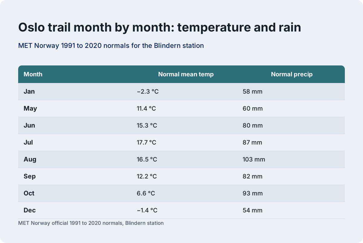
The best hiking months near Oslo are May through September, when the forest trails are dry, the lakes are warm enough to swim in, and daylight runs from 17 hours in mid-May to over 18 hours at the summer solstice. July's normal mean of 17.7 degrees Celsius is mild rather than hot. Winter, December to March, swaps hiking for snowshoeing and skiing on groomed trails. April and October are the shoulder months, pretty but wetter.
The numbers behind that answer come from MET Norway's official 1991 to 2020 normals for the Blindern station in Oslo, and they are worth seeing laid out because they shape what each month on the trail feels like. Two inversions matter for planning: August, at 103 mm, is Oslo's wettest month on the normals, not November, and the winter, not the summer, is the extreme season. Other pages covering the same trip are gathered on Oslo Travel Guide. Other pages covering the same trip are gathered on Oslo Travel Guide.
| Month | Normal mean temp | Normal precip | What it means on the trail |
|---|---|---|---|
| Jan | −2.3 °C | 58 mm | Snow underfoot, snowshoes or skis, short days |
| Mar | 1.3 °C | 41 mm | Late-winter snow, best snowshoe window opens |
| May | 11.4 °C | 60 mm | Dry forest paths, first swimming |
| Jun | 15.3 °C | 80 mm | Long light, warm lakes |
| Jul | 17.7 °C | 87 mm | Peak season, mild days |
| Aug | 16.5 °C | 103 mm | Wettest month: pack rain gear |
| Sep | 12.2 °C | 82 mm | Cool, colorful, quieter trails |
| Oct | 6.6 °C | 93 mm | Shoulder season, muddy paths |
| Dec | −1.4 °C | 54 mm | Dark by 15:11 at midwinter |
Observed extremes in the recent record underline the range: 32.9 °C on 15 July 2026 at Blindern, against −17.2 °C on 11 January the same winter. Neither is typical, but both are possible, which is the argument for checking the forecast rather than the calendar.
Daylight is the planning variable visitors underestimate most. On 21 June the sun sets at 22:43 and rises at 03:53, and the gap between is twilight rather than true night, so an evening walk after dinner is entirely reasonable. On 21 December the sun rises at 09:18 and sets at 15:11, so a winter hike is a lunchtime activity or nothing. Our Oslo daylight hours guide carries the full table, and the best time to visit Oslo weighs the same trade-offs for the trip as a whole.
What Should You Pack for Oslo Trails?
Pack for the season, not the distance: in summer, layers, a swimsuit for the lakes, water and rain gear, because August alone averages 103 mm of rain. In winter, proper insulated boots, traction or snowshoes, a headlamp and warm layers, because the sun sets before 15:30 in December and temperatures can drop far below the normal of around −2 °C. The trails themselves are free and need no permit, map purchase or booking.
Summer packing is straightforward Scandinavian hillwalking: shoes with grip, a layer for the wind that comes off the fjord, and something to swim in, because the lakes and the island coves are the point of a warm day here. Water temperature in July and August typically sits between 15 and 20 °C, cool but genuinely swimmable, and the official swimming spots, Sørenga, Huk, Paradisbukta and Langøyene among them, are free and public.
Winter packing deserves more respect than the normal temperatures suggest. The monthly means hover just below freezing, but the observed low in the 13 months to August 2026 was −17.2 °C, and the wind on the ridge above Frognerseteren adds to that. Snow depth is not something to guess at: Skiforeningen's live reports are the primary source, and the metro line runs year-round to Frognerseteren regardless of conditions.
One item you do not need to pack is a paper map bought in advance. The trail network is signed, and the Ruter app handles the journey to the trailhead. A charged phone with the forecast loaded covers the rest.
Can You Hike Near Oslo in Winter?
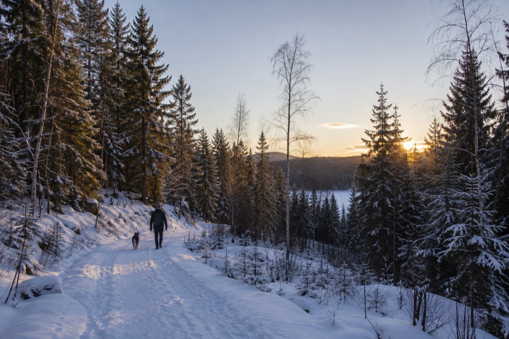
Yes, and winter is arguably when the forest around Oslo is at its most distinctive, but the activity changes name: from December to March the trails are snow-covered and the honest options are snowshoeing, cross-country skiing on Skiforeningen's groomed network, or a torchlit evening walk. Metro Line 1 runs to Frognerseteren year-round, so access does not change. Daylight does: on 21 December the sun is up for 5 hours 53 minutes, so plan winter walks around midday.
Snowshoeing is the closest thing to winter hiking, and it is genuinely a bookable half-day in Oslo, which is rare for a European capital. The guided version runs about three and a half hours in Nordmarka, and it exists precisely because the groomed ski trails are for skiers, leaving walkers needing either their own equipment or a guide who brings it.
Skiing is the other winter answer, and it comes in two flavors: the groomed Nordmarka network for cross-country, and Oslo Vinterpark at Tryvann for downhill, both covered in our skiing near Oslo guide. The Korketrekkeren toboggan run, which starts near Frognerseteren, is a third option and a memorable one, generally free or low-cost for public use.
If you want the winter forest without the sport, the torchlit evening walk is the product built for that: about three and a half hours, by torchlight, ending at a campfire. It is the dark-season experience Oslo actually needs from October to March, when the evenings are long and the forest is closed to anything without a light.
For a wider look at the season, Oslo in winter and Oslo winter day trips both cover the city's cold-weather options, and day trips from Oslo without a car handles the transport question for every season.
What Does Guided Hiking Near Oslo Cost?
Guided hiking options near Oslo run from free, tip-based city walking tours to mid-range half-day forest experiences: the fjord-view hike with waffles, guided snowshoeing, and the torchlit campfire walk all sit in a comparable band, with the full-day five-island boat tour a step above them. Every figure here comes from the live listing, and every one of these products carries real verified prices rather than estimates.
The value question is worth asking honestly. The trails are free and the transport is a few NOK on the T-bane, so what a guide sells is not access. It is route-finding in a forest you do not know, equipment you did not pack, a meal you did not carry, and in winter, the difference between a cold walk and a warm one. For a visitor with one or two days in the city, that trade often makes sense, and for a visitor with a week it often does not.
The strongest of the guided products, and the one this site rates as the default, is the fjord-view hike: a perfect 5.0 rating across 211 reviews, about three and a half hours, with a chef-cooked Norwegian waffle stop in the forest. You can read the full breakdown on the fjord-view hike tour page, and Check availability if the date is firm. For the winter version, the snowshoeing tour page carries the details.
Budget travelers are not shut out. The free walking tours cover the city center rather than the forest, but they cost nothing up front and they are a good first-morning orientation before you head uphill. And if your outdoor appetite runs to water rather than trails, the packrafting trip down the Akerselva is the odd, wonderful middle option: an urban river, a raft, and the city flowing past on both banks.
Planning a Hiking Day: The Short Version
A solid hiking day near Oslo looks like this: check Skiforeningen's trail report or the forecast, buy a Ruter ticket in the app, take Line 1 to Frognerseteren or the ferry from Aker brygge, walk, swim or snowshoe depending on the month, and be back in the center inside half an hour whenever you have had enough. Total cost for the do-it-yourself version is a public transport fare. The guided version adds a guide, equipment and lunch.
This is one of those rare destinations where the do-it-yourself version is not a compromise. The infrastructure, signed trails, year-round metro, public ferries, live condition reports, exists because a large share of the city's own population uses it weekly. You are borrowing the locals' weekend, not buying a tourist product.
That said, the guided products earn their keep in three specific cases: winter, when equipment and route knowledge matter; short trips, when half a day cannot absorb a navigation error; and food, when a chef-cooked waffle in the forest is worth more to you than the price of it. Everything else, the free trails, the free park at Vigeland, the free Opera House roof, sits in our free things to do in Oslo guide, and the wider outdoor picture, from hiking to skiing to beaches, is gathered under hiking in Oslo.
Wherever you land on the guided question, one piece of advice holds: trust the daylight table over your instincts. A June evening walk that ends at 22:00 in full twilight and a December walk that must end by 14:30 are the same trail, and planning for the second as though it were the first is the single most common mistake visitors make in this forest.
Common Questions About Hiking Near Oslo
Can you hike near Oslo without a car?
Yes, and it is one of the city's defining features. Metro Line 1 reaches Frognerseteren and Holmenkollen at the edge of Nordmarka in about 15 to 20 minutes from Nationaltheatret, and Ruter's island ferries leave from Aker brygge on an ordinary ticket. No trailhead near Oslo requires a car.
What is the best month for hiking near Oslo?
May through September. July's normal mean is a mild 17.7 °C, June gives over 18 hours of daylight, and the lakes are warm enough for swimming from midsummer. August is the wettest month on the 1991 to 2020 normals at 103 mm, so pack rain gear even in high summer.
Can you hike in Oslo in winter?
Yes, but the activity changes. From December to March the trails are snow-covered, so the honest options are snowshoeing, cross-country skiing on Skiforeningen's groomed network, or a torchlit evening walk. Daylight on 21 December lasts only 5 hours 53 minutes, so plan winter walks around midday.
Is hiking in Nordmarka free?
Yes. The trails are free, open and marked, and access is by ordinary public transport. Skiforeningen grooms the winter network and publishes live trail and snow-depth reports at no cost. You only pay if you book a guided hike, snowshoe outing or equipment.
How do you get to the Oslofjord islands for a hike?
Take the Ruter ferry from Aker brygge. The B1 line runs year-round to Hovedøya, Lindøya, Gressholmen, Bleikøya and Nakholmen on an ordinary ticket, and the summer-only B2 adds Langøyene. Do not confuse this with the Bygdøy museum ferry, a separate operator from Rådhusbrygge 3 that does not accept Ruter tickets.
Do you need a guide to hike near Oslo?
No. The trail network is signed and the transport is simple. A guide earns the price in three cases: winter, when equipment and route knowledge matter; very short trips, where a navigation error costs half your day; and food, since the best-reviewed guided hike includes a chef-cooked waffle stop in the forest.