Langøyene: Oslo's Swimming and Camping Island in the Oslofjord
Langøyene is the farthest-flung of Oslo's public ferry islands and the one locals pick for beaches, barbecues and a night under canvas, all on an ordinary Ruter ticket.
Short answer
Langøyene is the southernmost island served by Oslo's public ferries, reached on line B2 from Aker brygge in summer on an ordinary Ruter ticket or Oslo Pass. It has the best beaches in the Oslofjord island group, camping allowed up to two nights in season, and open grassland for walking.
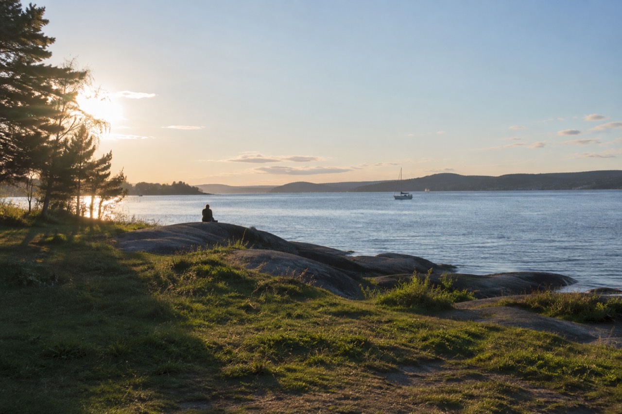
Langøyene is the island Oslo locals actually go to when the weekend is warm. It is the southernmost stop on the city's public ferry network, a long green ridge of grass, smooth rock and shallow beaches sitting out in the Oslofjord, and unlike almost every other capital-city island you could name, you reach it on a normal public transport ticket. No tour booking, no charter boat, no private pier. You tap the same ticket you used on the tram that morning and the boat takes you out.
That ordinariness is the whole point. The Oslofjord islands, covered in depth on the Oslofjord islands overview, are one of the few city archipelagos in Europe where the ferries are municipal transit rather than tourist cruises, and Langøyene is the far end of that network: the biggest island, the one with the best swimming, and the only one where camping is part of the deal. This guide covers how to get there, when the boats run, what the water is actually like, where you can pitch a tent, and how it compares with its neighbors.
What Is Langøyene?
Langøyene is the largest and southernmost of the Oslofjord islands served by Oslo's public ferries, a former farm and grazing island that is now open recreational land with beaches, cliffs, grassland and ruined military structures. It sits at the far end of the B2 ferry route from Aker brygge and is the island Oslo residents choose for swimming, sunbathing and overnight camping.
The name means "the long islands," and the island is indeed long: two low ridges joined by an isthmus, with the western side sheltered and shallow and the eastern side more exposed, rockier and facing the open fjord. For centuries it was farmed, and later the military took parts of it, which is why you keep stumbling on low stone ruins, earthworks and old foundations half-swallowed by grass. In the twentieth century the city opened it to the public, and today it functions as Oslo's backyard beach.
What makes it unusual in a European context is the combination of access and wildness. You are roughly twenty minutes by boat from the City Hall pier, yet the island has no shops, no restaurant and no permanent residents. Whatever you want for the day, you carry it on. There are toilets and maintained barbecue and picnic areas, but the rest is grass, rock, birch scrub and sea. For a fuller picture of the island group, see the Hovedøya monastery island guide, which covers the closest and most historic of the neighbors.
How Do You Get to Langøyene from Central Oslo?
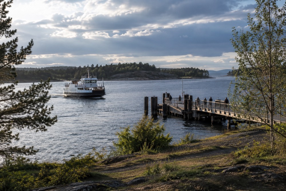
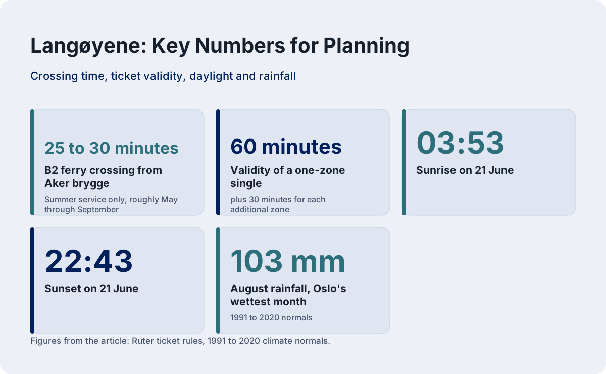
Take Ruter ferry line B2 from the Aker brygge pier area in central Oslo. Langøyene is only served in the summer season, roughly May through September, and the crossing takes about 25 to 30 minutes. An ordinary Ruter zone 1 ticket or an Oslo Pass covers the whole ride, with no island surcharge and no separate ferry fare.
The pier detail matters, because Oslo has two boat systems that leave from two different places and do not accept each other's tickets. The island ferries, lines B1, B1X and B2, depart from the Aker brygge side of the harbor. The Bygdøy museum ferry departs from Rådhusbrygge 3 on the City Hall side, is run by a different operator, does not accept Ruter tickets at all, and never goes to the islands. Visitors mix these up constantly, and the result is a wasted half hour at the wrong pier. If your destination is an island, walk to Aker brygge.
Buy your ticket before boarding, in the Ruter app or at a machine, because tickets bought on board the boat cost more. A single zone 1 ticket covers the crossing and stays valid for the return as long as you travel within its validity window, which Ruter states is 60 minutes for a one-zone single plus 30 minutes for each additional zone; for a full island day, a day ticket or an Oslo Pass is the practical choice. The Oslo Pass, at 580 NOK for 24 hours, 845 for 48 and 995 for 72 in 2026, includes Ruter transport in zones 1, 2, 3, 4V and 4N, which covers every island ferry.
| Route | Departure point | Serves Langøyene | Ticket needed |
|---|---|---|---|
| B1 (year-round circle) | Aker brygge | No, Hovedøya, Lindøya, Gressholmen, Bleikøya, Nakholmen | Ordinary Ruter ticket or Oslo Pass |
| B1X (summer extra) | Aker brygge | No, express to Hovedøya | Ordinary Ruter ticket or Oslo Pass |
| B2 (summer only) | Aker brygge | Yes, Langøyene via Hovedøya and Gressholmen | Ordinary Ruter ticket or Oslo Pass |
| Bygdøy museum ferry | Rådhusbrygge 3 | No, museum peninsula only | Own fare, Oslo Pass accepted, Ruter tickets not valid |
If you would rather see the islands from the deck of a sightseeing boat than plan ferry timetables around them, the fjord cruise options on the Oslofjord cruise guide run year-round and circle the same waters.
When Do the Ferries to Langøyene Run?
The B2 ferry to Langøyene is a summer-season service. Ruter's 2026 schedule runs a summer timetable from 4 July to 30 August and an autumn timetable from 31 August to 18 October, with departures roughly every 30 minutes to an hour during the day. Outside the season there is no ferry to Langøyene at all.
That last sentence is the one to plan around. Langøyene is not a year-round destination by public boat. The B1 line, which serves the closer islands, runs all year with reduced frequency off-season, but Langøyene sits at the end of the B2 branch and that branch simply stops when the season ends. If you are visiting Oslo between late October and early May and want an island, Hovedøya is the honest answer, and it is covered in the guide linked above.
In high summer the service is generous: boats from mid-morning through the evening, frequent enough that you do not need to build the day around a single departure. Always check the live timetable in the Ruter app or on ruter.no before you go, because the last boat back is the one that matters. The evening return schedule tightens in the autumn window, and an island with no shops is an unforgiving place to be stuck.
The island's summer season also lines up with Oslo's daylight, which is the quiet advantage of a Langøyene evening. On 21 June the sun rises at 03:53 and sets at 22:43, and the hours between are long twilight rather than true darkness. A late ferry back with the fjord still glowing is one of the genuine Oslo summer experiences, and it costs nothing beyond the ticket you already hold.
Can You Swim at Langøyene, and How Warm Is the Water?
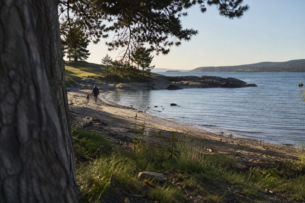
Yes, and Langøyene has the best swimming of any island in the Oslo group, with real sandy shallows on the sheltered side and rock-and-cliff swimming on the exposed side. Realistic July and August water temperatures in the Oslofjord run 15 to 20 degrees Celsius, cool rather than cold, and the beaches are free public space with no entry fee.
The western, sheltered side of the isthmus is where families set up: sandy bottom, shallow gradient, water that warms fastest because it is protected. The eastern side faces the open fjord, the water is deeper and clearer, and locals jump from the rocks. Both are free, both are public, and there are no facilities beyond toilets and barbecue stands, so bring what you need.
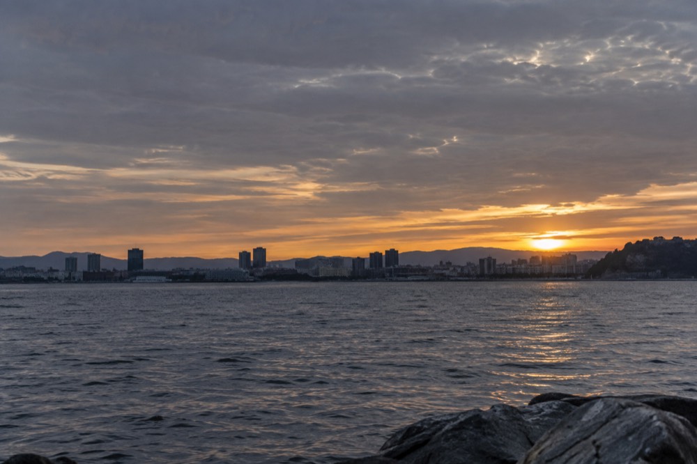
Fifteen to twenty degrees deserves an honest gloss. This is the North Sea watershed, not the Mediterranean, and a warm summer pushes the fjord toward the top of that range while a cloudy fortnight drops it toward the bottom. Oslo's official swimming spots, listed among the city's best beaches and swim spots, publish live bathing water temperatures in season, and it is worth a look before you commit the day. What the numbers do not capture is the setting: swimming off Langøyene means looking back at a capital city skyline across open water.
| Month | Normal mean air temp | Typical fjord water | Daylight on the 15th |
|---|---|---|---|
| June | 15.3 °C | 14 to 18 °C | 17 h 08 m |
| July | 17.7 °C | 16 to 20 °C | 18 h 02 m |
| August | 16.5 °C | 16 to 19 °C | 15 h 38 m |
| September | 12.2 °C | 13 to 16 °C | 12 h 54 m |
One planning note from the climate record: August is Oslo's wettest month on the 1991 to 2020 normals, at 103 mm, ahead of November. Summer rain on an island with no shelter beyond your own tarp is a real possibility, so pack accordingly even in the best swimming month.
Can You Camp on Langøyene?
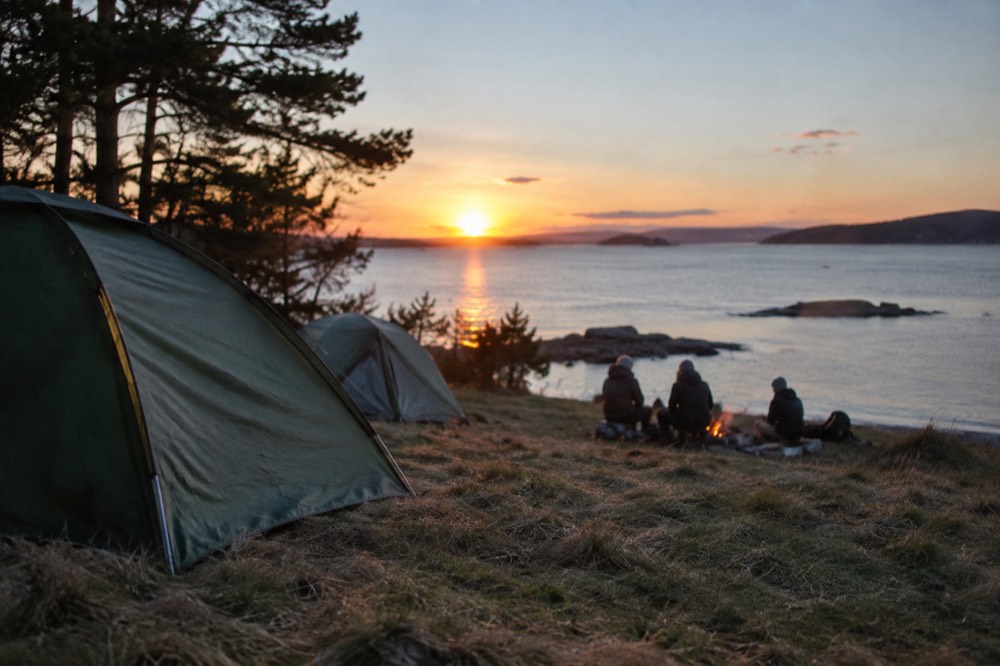
Yes. Langøyene is the only Oslofjord island where tent camping is part of the arrangement, with free camping allowed for up to two nights in designated areas during the season. There are no bookings, no pitches and no fees; you bring a tent, choose a spot within the permitted zone, and follow the leave-no-trace rules the city publishes.
This is the feature that separates Langøyene from every other island in the group and from almost every other capital city in Europe. Hovedøya, Lindøya and Gressholmen are day-trip islands with cabin communities and restrictions. Langøyene is deliberately kept as open recreational land, and an overnight stay is the way to get the place at its best: the day-trippers leave on the late afternoon boat, and the long summer twilight, which at midsummer means it never gets properly dark, belongs to the people in tents. The rest of the planning pages sit on Oslo Travel Guide. The rest of the planning pages sit on Oslo Travel Guide.
The rules are simple but real. Two nights is the ceiling, fires are only permitted at the established barbecue stands, and you carry out what you carry in, because there is no shop and no service. Confirm the current camping terms with the city before you pitch, since rules on Norwegian public land are periodically adjusted, and the ferry schedule on your second day matters: know your boat back before you settle in.
For campers and day visitors alike, the practical kit is the same, and it is short:
| Item | Why it matters on Langøyene |
|---|---|
| Water, more than you think | No shops, no kiosk beyond occasional seasonal sales, no drinking water points on the beaches |
| Food for the day | Nothing is sold on the island; the last supermarket is at Aker brygge |
| Windproof layer | The exposed side of the island catches the fjord breeze even on warm days |
| Swimwear and towel | The whole point of the crossing |
| Rubbish bag | Pack it in, pack it out; bins are limited |
| Tent and sleeping mat | Only if staying the night, within the two-night camping allowance |
What Else Is on the Island: Trails, Ruins and Nature?
Beyond the beaches, Langøyene is a walking island: a network of informal paths crosses grassland, birch scrub and rocky outcrops, past the ruins of military installations and old farm buildings, with the high points giving wide views back over the Oslofjord toward the city. A slow loop of the island takes about an hour to ninety minutes on foot.
The ruins are the part most visitors under-prepare for. The military remains, low walls, earth banks and the footprints of old batteries, are unlabelled and half-hidden in the grass, which makes them more atmospheric rather than less. The eastern ridge is the wilder half, with exposed rock and heathery ground, while the isthmus and the western shore are the tame, social half where the barbecue areas sit. Birdlife is noticeable, especially on the quieter eastern side, and the island's grass is managed by grazing in places, which keeps the landscape open.
The island is flat enough that anyone can walk it, and the loop is genuinely the best way to spend the middle of the day: swim in the morning while the sand is empty, walk the loop after lunch, swim again before the return boat. For visitors who want a guided version of island nature, the ferry-and-foot island hopping tour walks the same archipelago with a guide, and it pairs naturally with an independent Langøyene day.
Langøyene Versus the Other Oslofjord Islands
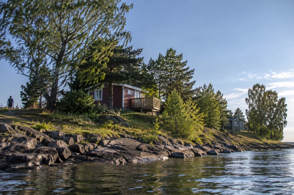
Choose Langøyene for beaches, camping and open space; choose Hovedøya for history and the shortest crossing; choose Gressholmen for a small, quiet island with a beach bar feel in summer; choose Lindøya or Bleikøya for cabin communities and gentle walks. All are on the same Ruter ticket from Aker brygge, so the choice is about character, not cost.
The comparison is worth making explicitly, because the islands are close together and the ferry routes overlap, and picking the wrong one for your mood wastes a summer afternoon. The table below is the honest version:
| Island | Ferry line | Character | Best for |
|---|---|---|---|
| Langøyene | B2, summer only | Big, open, wild edges | Swimming, camping, a full day out |
| Hovedøya | B1, B1X, B2 | Wooded, historic, closest | Cistercian abbey ruins, a short trip, year-round access |
| Gressholmen | B1, B2 | Small, social | A quick swim and a lazy afternoon |
| Lindøya | B1 | Cabin island, quiet lanes | A gentle stroll, painted holiday cabins |
| Bleikøya | B1 | Tiny, residential | Peace, birdlife, almost no facilities |
| Nakholmen | B1 | Small, mixed cabins and nature | Escaping the crowds entirely |
If your interest is less in beaches and more in seeing the whole archipelago in one sweep, the guided premium silent boat cruise runs a longer circuit of the fjord with commentary, and the traditional wooden sailing ship does the same waters under sail. Both are covered on the fjord cruise page linked earlier.
Is Langøyene Worth a Half Day?
Yes, for anyone visiting Oslo between June and early September who wants the city's best swimming, a real island walk, or a night of camping within a public transport ticket of the center. It is not worth the crossing outside the ferry season, in cold or wet weather, or for travelers whose priority is museums and city sights rather than open air and water.
The honest framing is this: Langøyene is a beach-and-outdoors destination, and Oslo, unusually for a European capital, delivers it as free public space on a transit ticket. If your Oslo days are built around the top things to do in the city, the museums, the Opera House roof, Vigeland Park, then Langøyene is the change of pace on the afternoon you would otherwise spend shopping. If your Oslo days are built around summer light and swimming, it is not a side trip at all, it is the main event.
Budget-wise it is one of the cheapest full experiences in an expensive city. Norway is the sixth most expensive country in Europe on Statistics Norway's 2025 price-level survey, with household prices 28.6 percent above the EU average, and a day in Oslo's restaurants makes that vividly clear. A Langøyene day makes it irrelevant: the ferry is a ticket you likely already hold, the beach is free, the walk is free, and the only real cost is the food you bring. It belongs on any budget Oslo itinerary, alongside the genuinely free sights like Vigeland Park, which is open 24 hours a day, all year, no ticket.
For the full picture of what the fjord offers from the deck of a boat rather than the shore of an island, the silent electric fjord cruise with audio commentary is the most-reviewed activity in the city and the natural companion to an island day.
Common Questions About Langøyene
How do I get to Langøyene?
Take Ruter ferry line B2 from the Aker brygge pier area in central Oslo, in summer only. An ordinary Ruter zone 1 ticket or an Oslo Pass covers the crossing, with no surcharge. The trip takes roughly 25 to 30 minutes.
When do the ferries to Langøyene run?
Only in the summer season. Ruter's 2026 schedule runs a summer timetable from 4 July to 30 August and an autumn timetable from 31 August to 18 October. Outside that window there is no ferry service to the island.
Can you camp on Langøyene?
Yes. Langøyene is the only Oslofjord island with camping as part of the arrangement, allowing free tent camping for up to two nights in the permitted areas during the season. Bring everything you need, carry out your rubbish, and confirm current rules with the city before pitching.
Is the water warm enough for swimming?
Realistic July and August water temperatures in the Oslofjord run 15 to 20 degrees Celsius. That is cool rather than cold, refreshing rather than balmy, and the sheltered sandy shallows on the western side of the island are the warmest swimming.
Are there shops or food on the island?
No. Langøyene has toilets and maintained barbecue and picnic areas, but no shops, no restaurant and no reliable kiosk. Buy food and drink at Aker brygge before you board and carry it with you.
Which island is better, Langøyene or Hovedøya?
Langøyene for beaches, camping and open space on a full day out. Hovedøya for the ruined Cistercian abbey, woodland walks, the shortest crossing and year-round ferry access. Both ride on the same ordinary Ruter ticket from Aker brygge.