Is Oslo a Walkable City?
Yes, Oslo is a genuinely walkable city: a compact centre, waterfront paths and car-light streets make most sights reachable on foot, with a few hills and museum-peninsula exceptions.
Is Oslo a Walkable City?
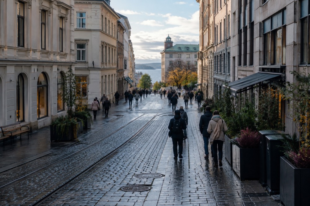
Yes, Oslo is a genuinely walkable city. The historic core between the Oslofjord waterfront and the palace gardens is compact enough that most first-time visitors cover it entirely on foot, the waterfront promenade runs continuously from Aker Brygge past the Opera House, and large parts of the centre have been deliberately re-engineered to favor pedestrians over cars. Walking is not just possible here, it is the normal way residents and visitors move through the middle of the city.
That answer surprises people who expect a sprawling Nordic capital. Oslo is Norway's largest city, but its tourist-relevant core is small and stitched together by water. The city rebuilt its entire seafront district over the past two decades, and the result is a continuous harbor-side walk that links the former shipyards of Aker Brygge, the new opera district at Bjørvika and the fortress point of Akershus in one uninterrupted line. You can stand at City Hall, look in almost any direction, and see something worth walking toward within fifteen or twenty minutes.
The walkability is also policy, not accident. Oslo's city government has spent years removing parking spaces from the centre, narrowing car lanes and widening sidewalks, and the city was recognized internationally for taking cars out of its downtown streets. What that means on the ground is simple: crossing the core on foot is pleasant in a way it rarely is in capitals of this size, and the streets around Karl Johans gate, the main ceremonial avenue between the Central Station and the Royal Palace, are as much for walking as for anything else.
There are limits, and this article covers them honestly. Oslo sits in a bowl of hills, one museum cluster sits on a peninsula across the water, and winter daylight is short. But none of those change the basic verdict: for a visitor spending two or three days in the city, shoes will carry you further than any ticket.
How Compact Is the Centre, Really?
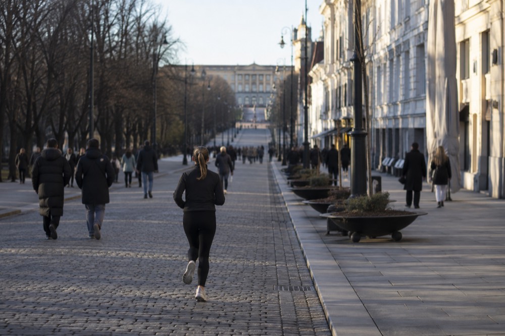
The sights most visitors come for sit inside a rectangle you can cross on foot in well under an hour in any direction. The Royal Palace at one end of Karl Johans gate and the Central Station at the other anchor a spine about a kilometer and a half long, with the Parliament, the National Theatre, the Cathedral and the university buildings strung along it. South of that spine, the harbor front and Akershus Fortress add a second walkable band, and the whole thing connects without a single awkward crossing.
The practical geography is a grid of a few named areas. Oslo Sentrum, the core, holds City Hall, the main shopping streets and the Cathedral. Aker Brygge, the redeveloped waterfront, sits immediately southwest with restaurants along the quays. Tjuvholmen extends that district out onto the water, home to the Astrup Fearnley museum. East across the mouth of the Akerselva river, Bjørvika holds the Opera House and MUNCH. All of these touch each other. There is no point in this list from which you would sensibly take transport to any other point in the list.
The Opera House deserves special mention because it is itself a walk, not just a building. Its sloping marble roof is a public space, free to climb at any hour, and the path up it is one of the most popular short walks in the city. Our page on the Oslo Opera House covers what to look for from the top. Similarly, the harbor promenade is not a single attraction but a chain of them, and the city signs it as a continuous route.
For orientation, the walk from the Central Station end of Karl Johans gate to the palace end is flat, straight and unmissable. From the palace you drop into the palace gardens and come out at the National Theatre, from where the waterfront is a few minutes further. A first afternoon in Oslo can be exactly this loop, on foot, with a coffee somewhere in the middle, and it touches most of the postcard list.
Which Neighborhoods Reward Walking Most?
The core is the obvious answer, but the neighborhoods that make Oslo feel like a real city are Grünerløkka and Frogner, both walkable from the centre in twenty to thirty minutes and both better on foot than by any other means. Grünerløkka, the old workers' quarter east of the Akerselva river, is a dense grid of cafes, vintage shops and street art. Frogner, west of the palace, is the leafy district around the sculpture park.
Grünerløkka is where the river walk begins, and the Akerselva itself is one of the best walking corridors in the city. The path follows the river from the Munch area in the north down through Grünerløkka to the harbor at Bjørvika, passing waterfalls, old industrial buildings converted to studios and the Mathallen food hall. You can walk the length of it in a relaxed morning. The river historically divided workers' east from wealthy west, and the contrast is still visible in the architecture on either bank, which is exactly what the themed free walks in the city make their subject.
Frogner's anchor is Vigeland Park, the sculpture park inside Frogner Park, and it is the single most visited sight in Norway on foot. The park is free, open 24 hours a day, all year, with no ticket of any kind, and holds over 200 granite and bronze figures by Gustav Vigeland arranged along a monumental axis. Our Vigeland Park guide covers the layout. From the park it is a straightforward walk back to the centre through tree-lined streets, or a short hop on the metro if your legs have had enough.
Between these two, and walkable from either, sit the smaller districts worth a detour: Vulkan with its food hall and climbing wall on the Grünerløkka side, and Majorstuen's shopping streets at the top of the Frogner side. If you want a structured version of the same ground, the Oslo walking route guide lays out a full day's circuit connecting the core, the river and the harbor.
Walking the whole core has one honest cost: it uses the same legs all day. The quiet way to break up a walking-heavy day is to put the city behind you for ninety minutes and see it from the water instead. The silent electric fjord cruise departs from the pier at City Hall, glides out past the fortress and the islands, and returns you to the same spot with a completely different sense of how the city is put together. It is the most-reviewed activity in Oslo for a reason, and it requires nothing from your feet.
Where Does Walking Stop Being the Answer?
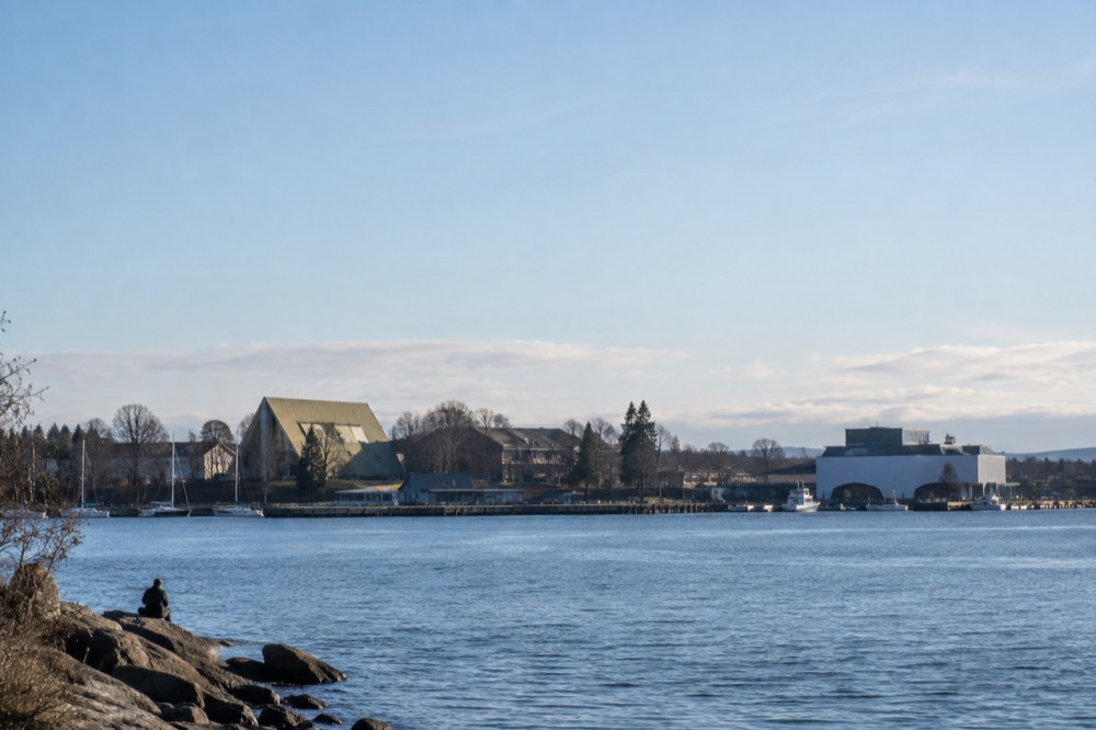
Three places: Bygdøy, the hills, and the dark weeks of December and January. Bygdøy, the museum peninsula, sits across the water from the centre and holds the Kon-Tiki, Fram and cultural history museums, plus the closed Viking Age museum, and reaching it on foot means a long detour or a seasonal ferry. The hills above the city, including Holmenkollen and the Nordmarka forest, are walking destinations in themselves but not walkable-to destinations.
Bygdøy is the exception visitors most need to plan for. The seasonal ferry from Rådhusbrygge 3 reaches the first stop in about ten minutes and runs every twenty minutes, but only from mid-March to early October, and ordinary Ruter tickets are not valid on it, though the Oslo Pass is. Year-round, bus 30 runs to the museums on a normal Ruter ticket. Once you are there, the museums themselves cluster walkably: Kon-Tiki, Fram and the Maritime Museum sit together at Bygdøynes, and the Folkemuseum a walk away at the Dronningen side. Our Bygdøy guide covers the layout, and the Kon-Tiki Museum guide covers the best-reviewed museum ticket on the peninsula.
The hills are the second exception, and a pleasant one. The metro, entirely inside Ruter zone 1, lifts you from the centre to Frognerseteren at the edge of Nordmarka in about twenty minutes, and from there the walking is forest trails rather than city streets. Holmenkollen, the ski jump visible from most of the city, has its own metro stop. These are trips where the sensible plan is transit up and legs down, or legs up and transit back. The Nordmarka guide covers the trailheads.
| Destination | Walk from centre? | Best alternative | Time on the alternative |
|---|---|---|---|
| Bygdøy museums (summer) | No, water in the way | Seasonal ferry from Rådhusbrygge 3 | About 10 min to first stop, every 20 min |
| Bygdøy museums (winter) | No | Ruter bus 30 | About 15 min from Nationaltheatret |
| Holmenkollen ski jump | Steep uphill walk | Metro Line 1 to Holmenkollen stop | Roughly 15 to 20 min |
| Nordmarka forest trails | No | Metro Line 1 to Frognerseteren | About 20 min |
| Oslofjord islands | No | Ruter ferry B1 from Aker Brygge, ordinary ticket | Short crossings, year-round line |
The winter daylight point deserves its own arithmetic. Oslo sits at 59.91 degrees north, and the swing between summer and winter is extreme: the longest day in late June runs 18 hours and 50 minutes, with the sun setting at 22:43, while the shortest day in late December offers 5 hours and 53 minutes, sunrise 09:18, sunset 15:11. There is no midnight sun at this latitude, but late June evenings stay light enough to keep walking well past ten. In December, plan your walking day around the middle hours and treat the long evenings as museum, restaurant and bar time.
Is the City Built for Pedestrians, or Just Small?
Both, and the pedestrian-friendliness is the part that distinguishes Oslo from merely compact capitals. The city has systematically removed cars from its core, converting parking to bike lanes and widened sidewalks, and the harbor front was rebuilt as a continuous public promenade rather than a working port cut off from the city. The result is a centre where the default assumption on most streets is that a person on foot has priority.
The harbor promenade is the clearest single piece of evidence. For decades the seafront between Aker Brygge and Bjørvika was docks and container yards. Today it is a linked walkway past the Astrup Fearnley museum at Tjuvholmen, through the restaurant quays of Aker Brygge, around the fortress walls of Akershus and along to the Opera House roof, with the MUNCH museum beyond it. Nothing forces you to detour inland or cross a service road. For a capital that made its living from the sea, turning its face back to the water was a choice, and walkers are the beneficiaries.
The car-reduction is the second piece. The city centre shed a large share of its street parking over the past several years, an internationally reported policy that was contested locally but has made the core measurably calmer. Cyclists benefit too, and the bike-share and path network means a bike is often the fastest way across the flat centre, something our Oslo bike share guide covers in detail. But the pedestrian is the design priority, and crossing the core on foot never feels like fighting traffic.
One honest note on comfort: Oslo's summer walking weather is milder than the city's reputation suggests. July's normal mean temperature is 17.7 °C, and even August averages 16.5 °C. The winter is the extreme season, with January means around minus 2.3 °C, and ice on sidewalks is a real feature of a January walking day. Studded winter footwear is what locals wear, and visitors discovering this in sneakers do not enjoy it. Our Oslo in winter guide covers the practical side.
Do You Even Need Public Transport on a Short Visit?
For two or three days concentrated on the core, the neighborhoods and the harbor, many visitors never buy a transport ticket, and the free walking tours that cover the centre make the same bet. Transport earns its money at the edges: the airport train, the metro to the hills, the bus or ferry to Bygdøy and the island ferries across the fjord. If your itinerary is the core plus one or two of those edges, a couple of single tickets beats any pass.
The free walking tour scene is built on exactly this walkability. The largest free walk in the city, a highlights tour with over two thousand reviews, covers the centre on foot in about two hours on a tip basis, and there are smaller themed alternatives including a contrasts-of-Oslo walk that takes in the east-west split along the river. Our Oslo free walking tours guide compares them. If you want a paid, fixed-price version instead, a guided central walk costs about as much as a sandwich and a beer, which in this city is the definition of cheap.
Where transport genuinely matters, the fares are worth knowing. The airport is the big one: Flytoget, the airport express, runs about 20 minutes to the Central Station at 268 NOK for an adult single, while Vy's ordinary trains cover the same distance in about 23 minutes at roughly half the price, and the Oslo Pass covers the Vy option but not Flytoget. Inside the city, everything relevant to a walker is zone 1, including the whole metro network, and the Bygdøy ferry and island ferries follow their own ticket rules that our Oslo ferries guide untangles.
The pattern that works for most short visits is simple: walk the core and the neighborhoods, use transit only for the hills and the peninsula, and put one boat in the middle of the trip to rest your legs and see the city from the water. The silent electric cruise fits that slot perfectly, departing from the City Hall piers that your walking day will pass anyway.
How Does Oslo Compare with Other Nordic Capitals on Foot?
Oslo is smaller and less dense than Stockholm or Copenhagen, which works in a walker's favor for a short visit: the sight-list is more concentrated and the distances between districts are shorter. Copenhagen has the stronger cycling culture and Stockholm the grander waterside scale, but Oslo has the most walkable single core relative to its size, and its harbor promenade now rivals either city's waterfront for continuity. Where it loses is winter: Oslo is colder and darker in January than either, which shortens the walking season.
The comparison matters for itinerary planning. In Stockholm the classic sights spread across fourteen islands and you ride between them; in Copenhagen the center plus Christiania plus the palaces stretches across a wider flat area with bikes as the natural middle gear. Oslo's core is tighter than both. A visitor who walks in Oslo covers proportionally more of the essential list per hour than in either of its neighbors, and the hills that hem the city in also give it viewpoints, from the Ekebergparken sculpture park across the fjord to the palace hill, that flatter cities have to build towers to offer.
The trade-off is seasonal. Oslo's January mean of minus 2.3 °C is a real winter, and the 5 hours 53 minutes of daylight around the solstice means the walking day has hard edges. Stockholm is a degree or two milder, Copenhagen several. Visit any of them from May to September and the comparison collapses, because Oslo's long June evenings, with light until nearly eleven, are as good as walking conditions get anywhere in the region.
Common Questions About Is Oslo a Walkable City?
is oslo a walkable city?
Yes. Oslo's centre is compact, its harbor front is a continuous pedestrian promenade, and its main neighborhoods are reachable on foot within half an hour of the core. Most visitors cover the essential sights without any transport beyond their own shoes.
Can you walk everywhere in Oslo without using transport?
Almost, but not quite. The core, the river walk, Grünerløkka and Frogner are all walkable. Bygdøy's museums need a ferry or bus, the Holmenkollen and Nordmarka hills are best reached by metro, and the Oslofjord islands need a ferry.
Is Oslo flat or hilly for walking?
The centre and harbor are flat to gently sloping. The city sits in a bowl, with real hills to the north and west. Walking within the core is easy, while anything toward Holmenkollen or the forest involves climbing that most visitors handle by metro.
What is the best time of year for walking in Oslo?
May through September, when daylight runs long and the paths are clear. June offers up to 18 hours 50 minutes of daylight. Midwinter still works in the middle hours, but with under six hours of daylight and possible ice, plan a shorter walking day.
Is Oslo safe to walk around at night?
Oslo is generally a safe city by European standards, and the central streets and harbor promenade are busy in summer evenings until late. Normal city caution applies, as with any capital. Our Oslo safety guide covers the details neighborhood by neighborhood.
Do you need walking boots for Oslo?
No, for summer. Comfortable sneakers handle the pavements and promenade. In winter, yes: sidewalks ice over and locals wear studded soles, so proper winter footwear or slip-on ice grips make a January walk genuinely safer.
Oslo rewards the pedestrian as directly as any capital in Europe. Start on the promenade, climb the Opera House roof because it is free and it is there, follow the river north when the grid bores you, and save the transport money for a boat. More orientation help lives on the Oslo Travel Guide homepage, including how many days to give the city and what the seasons do to a plan.